Anaxee’s Climate Command Centre: Carbon Projects with Precision and Scale
When most people think about carbon credit projects, they imagine forests being planted or cookstoves being distributed. But what they often overlook is the backend engine- the systems, people, and technology that make sure these projects are done correctly, at scale, and with trust. That engine, at Anaxee, is called the Climate Command Centre.
Let’s take you inside.
What is the Climate Command Centre?
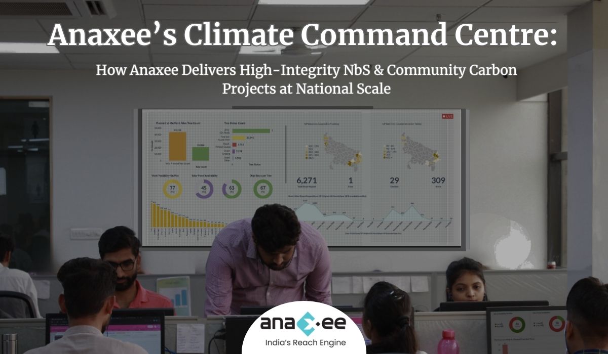
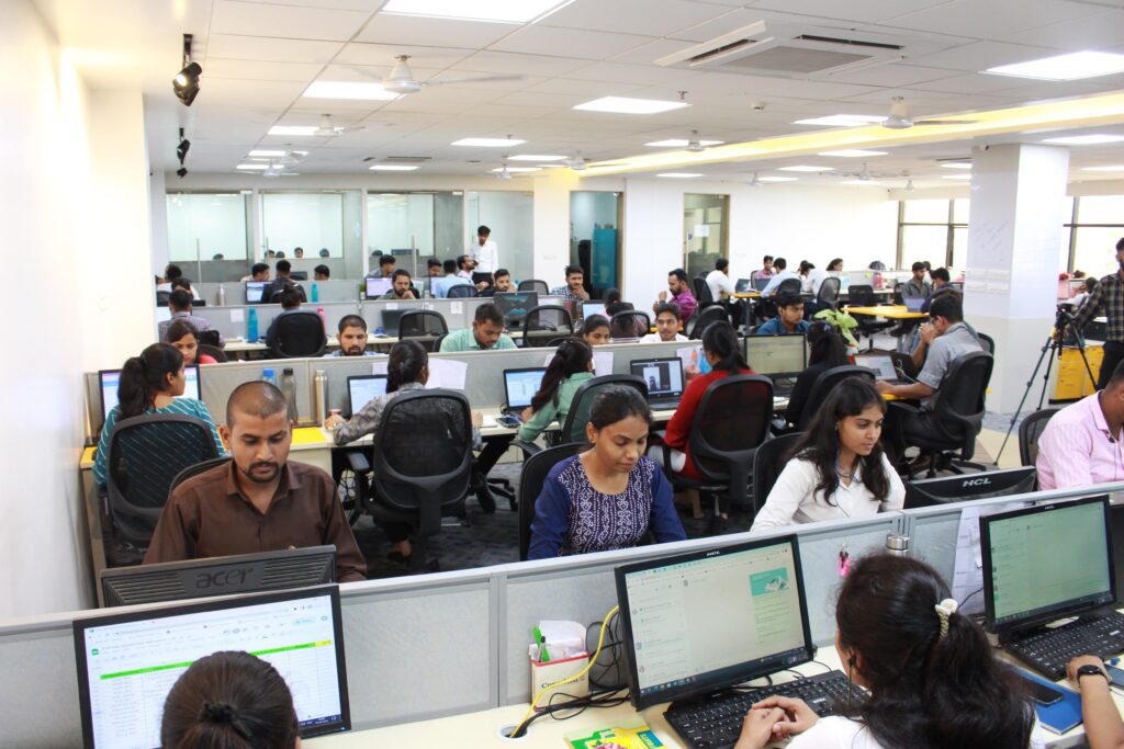
Anaxee’s Climate Command Centre is a centralised project management hub built to monitor and execute climate projects across thousands of locations in India. From tribal villages in Odisha to farming belts in Maharashtra, our Climate Command Centre operates like a control tower. It coordinates a workforce of 100,000+ Digital Runners, backed by a dedicated team of 125+ employees stationed at our headquarters.
While our Digital Runners collect ground-level data and engage with communities, our internal team reviews, guides, and manages the end-to-end lifecycle of each project.
We handle:
-Project planning & deployment
-Real-time monitoring of ground activity
-Continuous training
-Quality checks
-Data validations
-Beneficiary onboarding
-Dashboards and Reporting
Let’s break down how it all works.
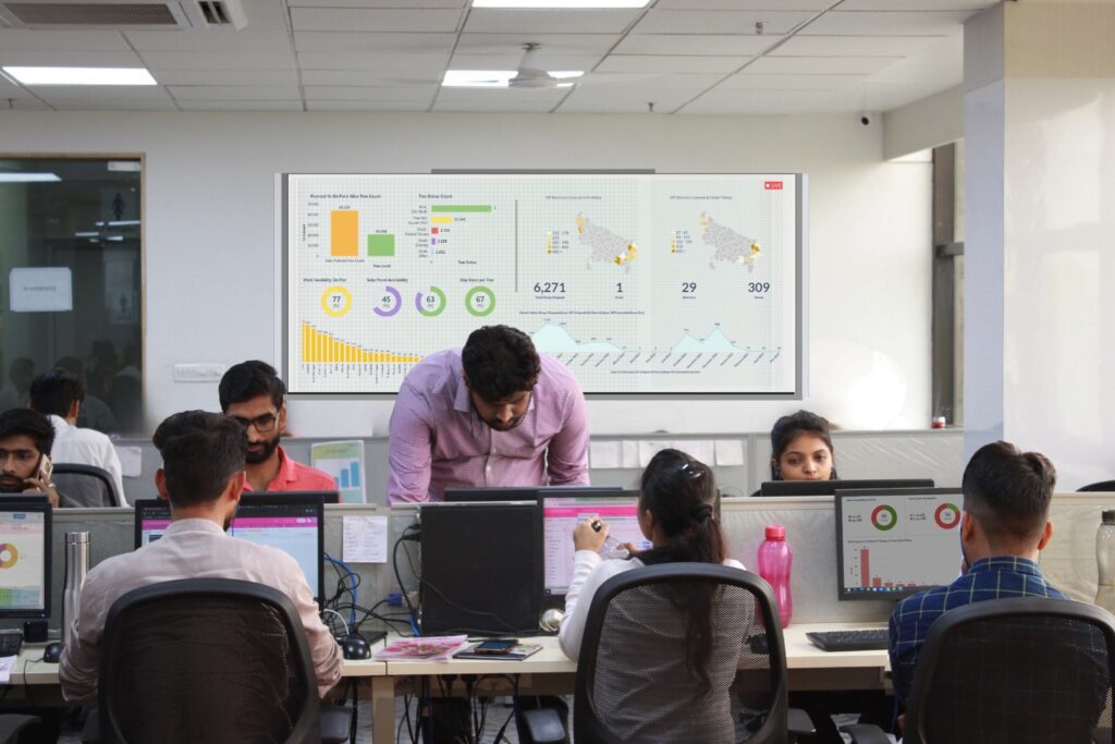
Our Secret Weapon: 125+ Team Members Coordinating Every Step
Executing a carbon project isn’t just about planting trees or delivering clean cookstoves. It’s about ensuring that every tree is planted at the right depth, every stove reaches a genuine beneficiary, and every piece of data is auditable. That level of precision is possible because of our dedicated 125+ team members, each assigned to specific processes.
Their work includes:
-Tracking Digital Runner activity in real-time
-Monitoring data uploads and location tagging
-Assigning and reassigning tasks based on data gaps
-Resolving field-level issues instantly
-Flagging quality issues for correction
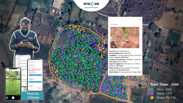
Example: Agroforestry Monitoring
In agroforestry, Digital Runners geo-tag tree pits, click pre- and post-plantation photos, and record species-level data. Our internal team validates if the pits meet depth requirements (e.g., 1x1x1 ft), reviews timestamped photos, and ensures sapling count matches the project design. If any issue arises, immediate feedback is sent to the Runner with corrective instructions.
This is project management at the micro level, scaled up across 5000+ villages.
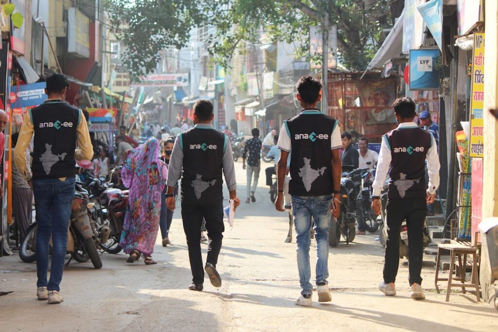
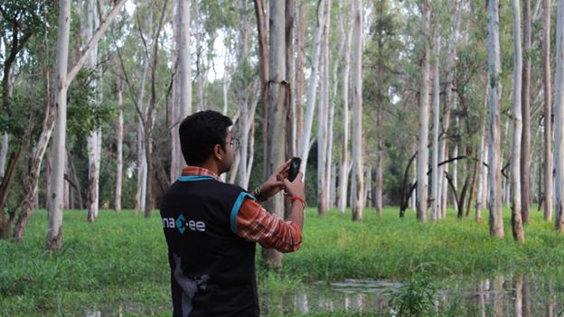
Localized Power: Why Digital Runners Are Key
Instead of parachuting people into rural areas, we hire Digital Runners from their own localities. This gives us several advantages:
-Trust: Locals are more welcomed by the community.
-Familiarity: They know local dialects, routes, and dynamics.
-Accountability: They stay in the same region and can be traced.
Digital Runners aren’t just data collectors. They are:
-Trained field agents
-Project ambassadors
-Beneficiary verifiers
We combine this local trust with robust backend support.
Training That Actually Works: From Zoom to Field
Before any Runner is activated, they go through a structured training program that includes:
-Video modules in regional languages
-Live Zoom sessions for Q&A
-On-ground field demos with supervisors
-Interactive quizzes to verify learning
Why Training Matters
In an Agroforestry project, if a sapling is planted incorrectly (e.g., shallow pits, incorrect spacing), it could die within months—invalidating future carbon credits. Training ensures:
-Accurate spacing and layout of plantations
-Correct species mapping
-Understanding of the project’s climate goal
We don’t assume knowledge. We train for it, test for it, and track it.
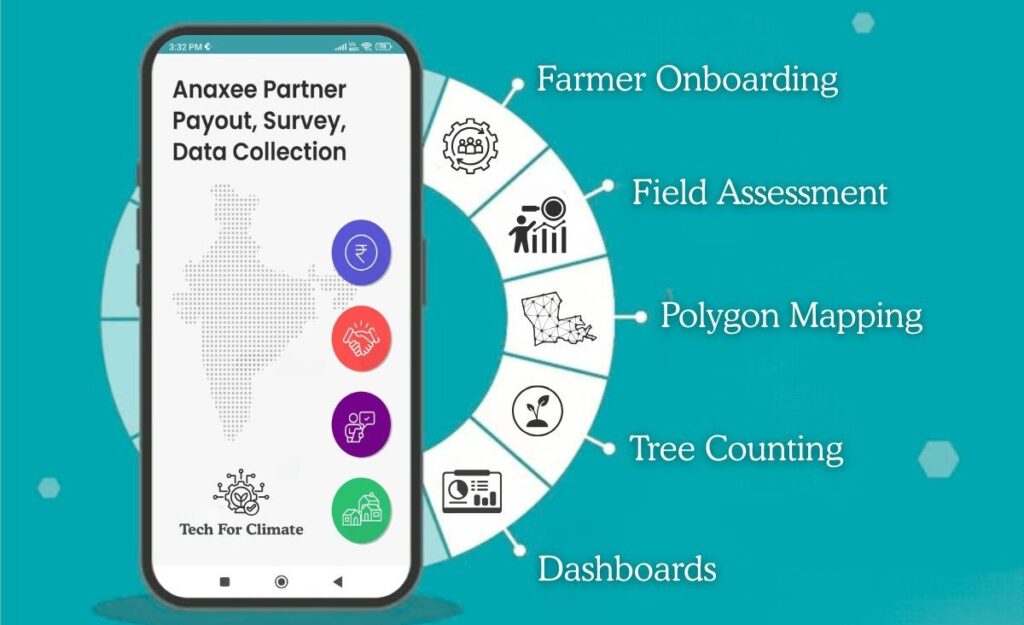
Our Digital Stack: Real-Time, Transparent, Traceable
Technology is the backbone of our project management. We’ve built a full-stack system that includes:
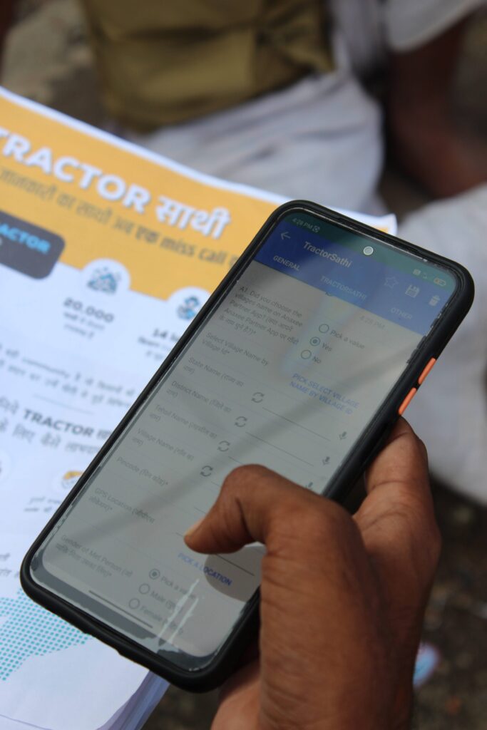
1. Anaxee Partner App
Used by Digital Runners to:
-Get assigned tasks
-Upload GPS-tagged images
-Fill in project forms
-Record feedback from the ground
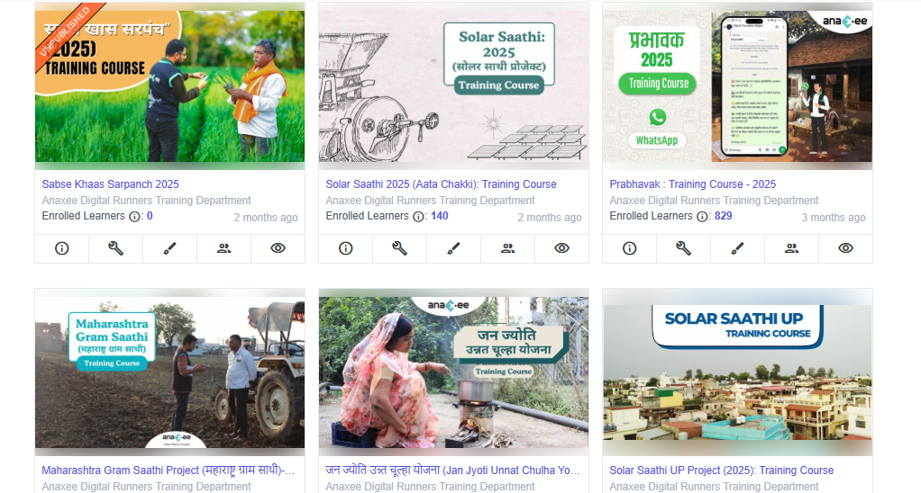
2. Training Portal
-Video content
-PDF manuals
-Language-specific quizzes
-Score tracking for certification
3. dMRV Platform
-Real-time tracking of Runner activities
-Quality control triggers
-Data analytics for trends
-Integration-ready with Verra, Gold Standard protocols
This is Digital MRV (Measurement, Reporting, and Verification) in action.
How We Do Quality Check of Data
Every image, every GPS point, and every form is checked and validated.
Here’s how:
-Images are auto-checked for time, location, clarity
-GPS points are verified using backend maps
-Forms are run through logic rules (e.g., sapling count vs. land size)
-Duplicate entries flagged
If a data point fails any check, a feedback loop is triggered, and the Runner is notified instantly.
Example: Clean Cooking Project
For clean cookstove distribution:
-Digital Runners collect beneficiary info, stove images, and usage confirmation
-Our backend team filters for low-income families using demographic indicators
-Only eligible households are onboarded
-Follow-up calls validate usage
Beneficiary Selection: No Guesswork
We have set processes to identify and validate beneficiaries. For example:
In Improved Cookstove Projects:
-Runners first survey the household
-Mobile app captures cooking method, wood usage, and household size
-Data runs through filters (e.g., LPG vs. firewood users)
-Only wood-using households below income threshold are approved
This ensures high additionality and methodological integrity.
Dashboards That Tell the Truth
Every stakeholder, from project developers to auditors, wants visibility. We provide it through:
-Real-time dashboards for plantation progress
-Maps showing exact geo-coordinates of beneficiaries
-Status trackers for sapling survival, device usage
-Weekly reports downloadable in CSV or PDF
It’s transparency by design, not just as a reporting requirement.
Human + Digital: Our Hybrid Model
What sets Anaxee apart is this hybrid model:
-Humans on ground: For empathy, trust, adaptability
-Tech on cloud: For scalability, accuracy, auditability
This balance allows us to:
-Scale fast without losing quality
-Pivot quickly when field realities shift
-Maintain end-to-end control
We Don’t Just Run Projects. We Command Them.
Calling it a “Climate Command Centre” isn’t just branding. It’s an operational reality.
Whether we’re planting 10 lakh trees, distributing 1 lakh stoves, or mapping 50,000 acres of land, every step is managed, measured, and improved in real time.
And behind it all is a team that cares, tools that work, and a vision that scales.
Why This Matters
Carbon markets are shifting toward high-integrity, high-auditability projects. Gone are the days when a generic CSR report would suffice. Today, every credit must be backed by:
-Verified data
-Transparent processes
-Community co-benefits
Anaxee is ready. And the Climate Command Centre is where it all comes together.
Interested in Partnering with Us?
If you’re a project developer, carbon registry, CSR leader, or climate investor—reach out. See how Anaxee’s Climate Command Centre can become your execution backbone in India. Connect with us at sales@anaxee-wp-aug25-wordpress.dock.anaxee.com
Anaxee Digital Runners Private Limited 303, Right-wing, (use Lift#1) New IT Park Building 3rd floor, Pardesi Pura Main Rd, Electronic Complex, Sukhlia, Indore,
Madhya Pradesh 452003