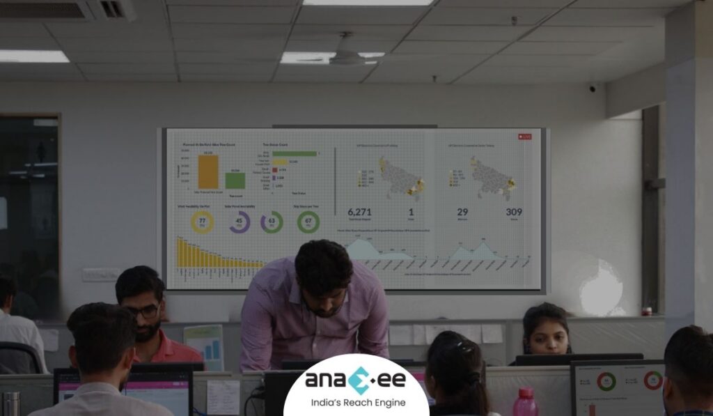
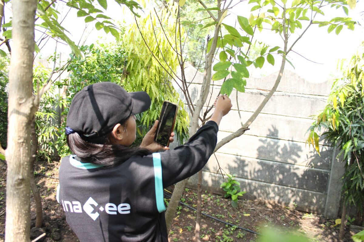
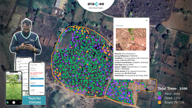
A tree census is a 100% count of every tree in an area, each with a GPS location, unique ID, species, girth, canopy and health, mapped on a GIS dashboard. What it records, how it is done in India, and why cities and companies need one.
Quick answer: A tree census is a complete count of every tree in a defined area — a city, a ward, a campus or an estate — where each tree is given a GPS location and a unique ID, and its species, girth, height, canopy and health are recorded and mapped on a GIS dashboard. Unlike a sample survey that counts a few plots and extrapolates, a census visits and records every single tree, which is what a Tree Act count, a biodiversity register or a defensible green-cover number requires.
About Anaxee
40,000+ Digital Runners · 540 districts · 26 states · 11,000+ pincodes of reach
★ Winner, National Startup Award (Govt. of India)Trusted by 350+ brands & institutionsIndia’s Reach Engine since 2016
Most people have never thought about how a city knows how many trees it has. The answer, increasingly, is a tree census — and it is a far bigger exercise than counting trees in a park. When a municipal corporation says a city has four million trees, or a company reports that its CSR plantation holds 50,000 saplings, that number came from somewhere. If it is credible, it came from a census: a structured, tree-by-tree count where every tree was found, located, identified and recorded.
This guide explains what a tree census actually is, what gets recorded for each tree, how one is carried out in India, and why cities and companies are moving from rough estimates to full, geo-tagged counts.
Why it matters now
4 million+
trees counted in Pune’s geo-enabled census — roughly one tree for every 1.27 people in the city
A number that precise is only possible when every tree is visited and pinned on a map — not estimated from the sky. That is the difference between a census and a survey.
Source: Pune Municipal Corporation geo-enabled tree census.
What is a tree census?
A tree census is a 100% count of the trees in a defined boundary. Every tree is physically visited, fixed to a GPS coordinate, given a unique identification number, and described by a set of attributes — its species, size, age and health. All of it is loaded onto a map, so the result is not just a total but a living, searchable record of where each tree stands and what condition it is in.
The word “census” is deliberate. A survey samples — it counts a few representative plots and extrapolates across the whole area. A census counts everything. For a street, a sample is fine. For a legal count under a Tree Act, a biodiversity register, or a green-cover figure a city will defend in public, only a census will do, because the moment anyone asks “show me the trees you didn’t count,” a sample has no answer.
Tree survey
samples a few plots, extrapolates
Tree census
visits & records every tree
A defensible, mapped record
What gets recorded for each tree
A tree census is only as useful as the data it captures per tree. A standard Indian municipal or institutional census records most of the following:
GPS location & unique ID. Every tree pinned to a coordinate and numbered, so it can be found again and never counted twice.
Species. Botanical and common name — the basis of a biodiversity register and diversity mapping.
Girth, height and canopy. The measurements behind age estimation, carbon stock and green-cover area.
Health and hazard condition. Healthy, diseased, hollow or dangerous — the data that guides pruning, removal and public safety.
Ownership and ward. Government, private or institutional land, by zone — so counts roll up the way a corporation reports them.
A dated, geo-tagged photo. One per tree, so every record can be checked against the ground instead of taken on trust.
Planning a tree census for a city, campus or plantation?
See how Anaxee runs a tree census and tree counting end to end — app, field teams, drones, AI quality-check and the data management — or talk it through with our team.
A modern Indian tree census is a GIS and GPS exercise, run in a clear sequence:
1. Scope and boundary
The area is defined — a city, a set of wards, a campus or a plantation — and the attributes to be recorded are fixed, usually against a Tree Act requirement or a reporting standard. A rough tree estimate sets the budget, because census work is priced per tree.
2. Field enumeration
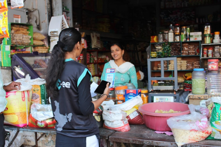
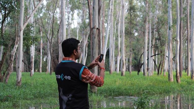
Trained enumerators walk the area, tree by tree. On a mobile app, each tree is geo-tagged, given its unique ID, identified by species, measured for girth, height and canopy, assessed for health, and photographed. Trees that can’t be identified on the spot are photographed for an expert to confirm.
3. Drone cross-check, where it helps
For large or open areas, drones add an aerial layer — an orthomosaic that counts canopy and whole-site totals to cross-check the ground count. Aerial imaging is powerful for scale, but it cannot identify a species under a canopy or read a tree’s health, so it supports the ground census rather than replacing it.
4. Quality control and data management
Records are checked for duplicates, impossible locations and visits that don’t add up; species names are reconciled; and the clean data is loaded onto a GIS dashboard with ward and species roll-ups, plus a biodiversity register.
5. Re-survey over time
Because every tree is geo-located, the same area can be counted again in the next cycle and compared — so a city can measure how its green cover is actually changing, not guess.
Fun fact: Ahmedabad’s municipal tree census was priced at about ₹7.89 per tree — a full-city count running into several crore rupees. When you are paying by the tree, every record has to be real, which is exactly why geo-tagged photos and quality checks matter.
Where technology and AI change the game
The old way — clipboards and spreadsheets — produced a number nobody could verify. A modern census runs on an app, so every tree arrives geo-tagged and time-stamped with a photo, flowing to a live dashboard. Then AI reads the field photos and flags the suspect records — a tree photographed twice, a location that is physically impossible, a run of captures logged too fast to be real — before a human quality-control team signs off. That is how a count of hundreds of thousands of trees stays honest and auditable. It is the same digital method now used in carbon project verification and drone-plus-ground-truth tree counting.
Who needs a tree census — and why
Cities and municipal corporations — a legal count under the Tree Act, a biodiversity register, and a baseline for green-cover planning and tree-felling permissions.
Companies and CSR teams — counting and verifying a plantation’s survival for BRSR and sustainability reporting, where “trees planted” must become “trees proven alive.”
Infrastructure and real estate — tree enumeration for environmental clearance and transplantation planning before construction.
Campuses, estates and communities — a one-time inventory of green assets, mapped and measured.
How Anaxee helps
Anaxee — India’s Reach Engine, a National Startup Award winner — runs field data collection and verification through 40,000+ Digital Runners across 540 districts and 11,000+ pincodes, with its own app, AI photo quality-check and back-office data team. For tree counting, that means a full tree census run end to end — or just the layer you are missing: the software, the field workforce, the drone count, the quality check or the data management. See how it applies to drone tree counting and plantation verification.
Proof — independent field verification at national scale
Independent, geo-tagged field verification delivered across all 26 states, with drone mapping and on-ground truth. See all case studies →
What happens when you reach out to Anaxee
Tell us the area — the city, ward, campus or plantation, and what you need counted — by form, WhatsApp or a call.
A real person calls back — our Indore team, within one working day.
We scope a pilot — one ward or site counted and verified, so you see the method and the data quality before you scale.
A 150+ person team in Indore and 40,000+ Digital Runners on the ground — your enquiry reaches people who run field data collection every day, not an inbox that goes quiet.
Frequently asked questions
What is a tree census in simple terms?
It is a count of every tree in a defined area where each tree gets a GPS location, a unique ID, and a record of its species, size and health, all mapped on a dashboard. It counts everything, rather than sampling a few plots and extrapolating.
What is the difference between a tree census and a tree survey?
A survey samples — it counts representative plots and estimates the total. A census counts every tree. A legal Tree Act count, a biodiversity register or a defensible green-cover figure needs a census; a quick indicative number can come from a survey.
How is a tree census done?
Trained enumerators walk the area and record every tree on a mobile app — geo-tag, unique ID, species, girth, height, canopy, health and a photo. Drones add an aerial cross-check on large sites, the data is quality-checked and cleaned, and it is delivered on a GIS dashboard with a biodiversity register.
What is recorded for each tree?
Typically: GPS location, a unique ID, species (botanical and common name), girth, height, canopy spread, age class, health or hazard condition, land ownership and ward, and a dated geo-tagged photo.
Why do cities conduct a tree census?
To comply with Tree Act requirements, build a biodiversity register, establish a green-cover baseline, plan planting and transplantation, manage hazardous trees, and make tree-felling permission decisions on real data rather than guesswork.
How much does a tree census cost in India?
It is usually priced per tree — city censuses have been tendered at roughly ₹7.89 per tree, which runs into crores for a full city. The cost depends on the number of trees, the area, the terrain and the depth of attributes recorded.
Can drones do a tree census on their own?
Not fully. Drones and satellites estimate tree numbers and canopy from imagery, which is useful for scale, but they cannot identify a species under a canopy or read a tree’s health, and they cannot satisfy a census that needs a human record per tree. They cross-check and support a ground census rather than replace it.
The bottom line
A tree census turns “about how many trees do we have?” into a mapped, verifiable record of every single one. It is more work than a survey — every tree visited, located, identified and photographed — but it is the only kind of count a city, an auditor or a funder will stand behind. Done on an app with geo-tagged photos and AI quality checks, it is also faster, cleaner and more honest than the clipboard era ever was.
Need a tree census run for your city, campus or plantation?
India wants a third of its land under tree cover; it’s at about a quarter. Agroforestry is a primary way to close that gap — and pay the farmer to do it. Here is how Anaxee runs the full on-ground lifecycle, from FPIC enrolment and plot geo-mapping to planting and multi-year monitoring.
Quick answer: An agroforestry carbon project plants trees on farmers’ land to sequester carbon and earn credits, while giving farmers fruit, timber and a share of the revenue. The concept is simple; the execution is not. Anaxee runs the full on-ground lifecycle — farmer enrolment with consent, geo-mapping every plot, nursery to planting, and multi-year monitoring — across 540 districts.
About Anaxee
40,000+ Digital Runners · 540 districts · 26 states · 11,000+ pincodes of reach
★ Winner, National Startup Award (Govt. of India)Tech for Climate — MRV & project executionIndia’s Reach Engine since 2016
India wants a third of its land under tree cover. Today it is at about a quarter. Agroforestry — growing trees alongside crops on the same farmland — is one of the few ways to close that gap without taking land out of farming, and it does something a plain plantation cannot: it pays the farmer, through fruit, timber and carbon-credit revenue, so the trees have a reason to survive.
The idea is well understood. What separates a real agroforestry carbon project from a nice intention is execution — enrolling thousands of smallholders with proper consent, mapping every plot, getting saplings in the ground, and keeping them alive and measured for years. That is ground work, and it is exactly what Anaxee does.
The gap agroforestry fills
25.17% → 33%
India’s forest and tree cover today, against its long-standing policy target of one-third of the land
Agroforestry on private farmland is a primary lever to move toward the one-third target, while turning carbon into farmer income.
Source: India State of Forest Report 2023 (25.17% forest & tree cover); National Forest Policy target of 33%.
What an agroforestry carbon project actually is
Trees planted on farmland capture carbon dioxide from the air and store it in wood and soil. That measured, verified sequestration can be issued as carbon credits. A company funds the project; farmers plant and tend the trees on their own land; the carbon revenue is shared with them, on top of the fruit and timber the trees bear. Done properly, it improves soil health and water retention, diversifies farmer income, and contributes to a long list of the UN Sustainable Development Goals — all while moving a buyer toward its net-zero and ESG commitments.
Why execution is the hard part
Thousands of smallholders. A project is not one estate — it is hundreds or thousands of small farms, each needing a conversation, a consent and a plan.
Every plot must be mapped. Carbon integrity depends on knowing exactly where each tree is — a GPS polygon of every field, not an approximation.
Trees have to survive for years. A sapling counted on day one is worthless if it dies in month three. The first three years need real maintenance.
It must be provable. Credits are only issued after third-party verification — so every step has to be measured, documented and defensible from the start.
How Anaxee builds an agroforestry project on the ground
Anaxee runs the end-to-end project lifecycle through its Digital Runner network and platform. In outline:
Select suitable geography
awareness + enrolment (FPIC)
Enrol farmers & geo-map each plot
nursery → planting, every tree tagged
Plant, maintain & monitor
field visits + satellite imagery
Verify & share revenue with farmers
Geography & land selection. Ecologists shortlist suitable regions; government records, satellite imagery and GIS pinpoint plantable farmland.
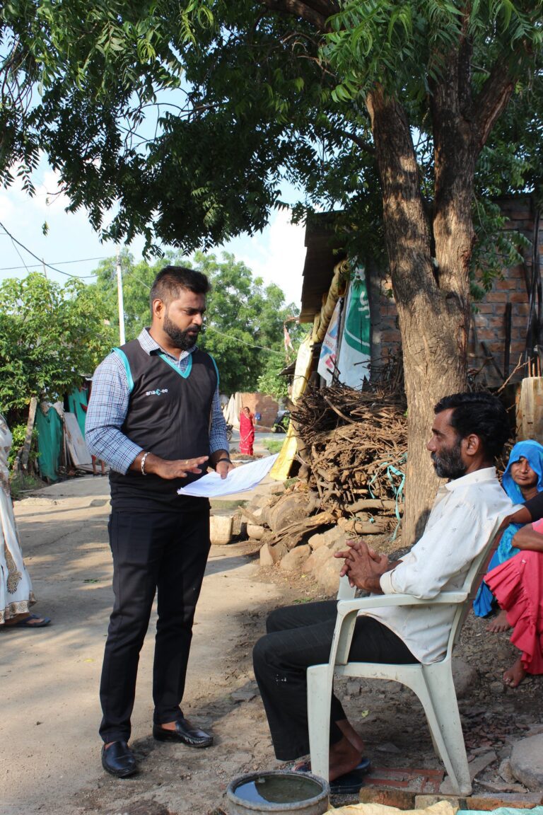
Awareness & enrolment with FPIC. Runners hold village meetings, explain benefits and fund flow, and register each farmer under Free, Prior and Informed Consent — plot, khasra number and tree preferences recorded.
Geo-mapping polygons. Each field is walked and captured as a GPS polygon — area in hectares, number of trees to plant — so every tree has a location on record.
Nursery, planting & tagging. Saplings are raised and distributed via gram-panchayat nurseries; each planted tree is counted and tagged with a unique ID in a central database.
Maintenance & monitoring. Focused upkeep through the critical first three years, agronomist visits, dead-plant replacement, and satellite NDVI to track vegetation health remotely.
Consent and the farmer’s cut are not optional
Two things make an agroforestry project credible: Free, Prior and Informed Consent from every farmer, recorded before planting begins, and a real revenue share so the carbon income reaches the people tending the trees — alongside the fruit and timber they already keep.
Get those right and the trees are cared for because it is in the farmer’s interest. Skip them and the project fails its first audit.
Planning an agroforestry or plantation carbon project?
None of this scales on paper. Runners capture every farm with photo, GPS, audio and a structured questionnaire — offline where there is no signal — on the Anaxee app, and it all lands in one centralized dashboard with map, heat-map and spreadsheet views that a project team or funder can filter and audit. Satellite imagery and NDVI track vegetation health and carbon stocks remotely between field visits, each tree carries a tagged identity in a central database, and AI assists on the data side — validating field captures, flagging anomalies and helping keep the record clean enough to stand up to third-party verification.
What farmers get
The model only works because it pays the farmer. On land that keeps producing crops, farmers add fruit and timber species — mango, guava, amla, jamun, custard apple, sapota and others — and receive a share of the carbon-credit revenue over the life of the project, with periodic payouts. Alongside the income come healthier soil, better water retention and a more climate-resilient farm. The incentive to keep the trees alive is built in.
Tell us the project — the geography, the scale, and the standard you’re working to — by form, WhatsApp or a call.
A real person calls back — our Indore climate team, within one working day.
We scope a pilot — one cluster of enrolled, geo-mapped farms with monitoring, on a dashboard you can open yourself.
A 150+ person team in Indore and 40,000+ Digital Runners on the ground — field execution a verifier can trust.
Tell us about your climate project
Share the geography and scale — our team will get back within one working day.
Frequently asked questions
What is an agroforestry carbon project?
Trees planted on farmers’ land, alongside their crops, that capture carbon over time. The verified sequestration can be issued as carbon credits, funded by a buyer, with the revenue shared with farmers on top of the fruit and timber the trees produce.
Does Anaxee issue or certify carbon credits?
No. Anaxee executes and monitors the project on the ground — enrolment, mapping, planting, maintenance and data — and provides the measured, documented evidence. Credits are issued by carbon standards after independent third-party verification.
Why does consent (FPIC) matter so much?
Because the farmer owns the land and the trees. Free, Prior and Informed Consent, recorded before planting, protects the farmer and is a baseline requirement for a credible project — without it, the project can fail verification.
How do you prove the trees are real and surviving?
Every plot is a GPS polygon, every tree is counted and tagged, maintenance runs through the critical first years, and satellite NDVI plus field visits track survival and growth — so the record is measured, not assumed.
What do farmers actually earn?
Fruit and timber from the trees, plus a share of carbon-credit revenue over the project’s life, with periodic payouts — alongside healthier soil and better water retention on their land.
How large can a project be, and how fast can you start?
From a single cluster of villages to multi-state programs across the 540-district network. Scope depends on geography, species and the standard you’re working to — book a short call to plan one.
The bottom line
Agroforestry is one of India’s best routes to its one-third tree-cover goal — and one of the few that pays the farmer to get there. But a carbon project lives or dies on execution: real consent, every plot mapped, trees that survive, and a record a verifier can trust. That on-ground discipline, across thousands of smallholders and hundreds of districts, is what Anaxee brings to the climate side of its work.
Carbon project verification (MRV) proves a plantation is real — the trees exist, survived and hold the carbon claimed. How Anaxee runs drone + ground-truth MRV across India.
Quick answer: Carbon project verification (MRV) is how you prove a plantation or restoration project is real — that the trees exist, survived, and hold the carbon claimed. Anaxee does it with drones for whole-site coverage plus on-ground measurement by its field network, delivered as a GPS-tagged live dashboard a developer, buyer or auditor can inspect from anywhere.
About Anaxee
40,000+ Digital Runners · 540 districts · 26 states · 11,000+ pincodes of reach
★ Winner, National Startup Award (Govt. of India)Trusted by 350+ brands — incl. Mahindra & ITCIndia’s Reach Engine since 2016
A carbon credit is a promise: that somewhere, one tonne of carbon dioxide was really removed or kept out of the atmosphere. In forestry and afforestation, that promise rests on trees — trees that have to actually be planted, survive, and grow. For a project developer raising finance, or a company buying credits to meet a climate target, the nightmare is simple: paying for trees that were never planted, quietly died, or got counted twice.
That is a verification problem. And verification is only as good as the evidence behind it — which is why MRV (measurement, reporting and verification) is the backbone of a credible carbon project.
The scale of what has to be measured
2.5–3 billion tonnes CO₂e
India’s pledged additional forest & tree-cover carbon sink by 2030
A pledge that size only counts if the trees behind it are real, survive and are measured — which is the entire job of MRV.
The trees exist. Not a plan or a projection — real trees on real ground, not phantom plantings on a spreadsheet.
Where they are. Each plot tied to a GPS coordinate, so the same trees can’t be claimed twice across two projects.
How many survived. Survival, not just planting, is what stores carbon — so counts have to be re-checked over time, not taken once.
How much they’ve grown. Carbon stock is estimated from tree size — diameter and height — measured on the ground, not guessed.
It can be checked again. Every figure anchored to a coordinate so next year’s survey compares like with like — change measured, not claimed.
How Anaxee runs MRV: drones plus ground truth
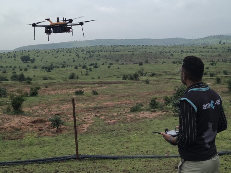
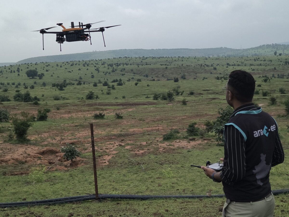
Anaxee pairs two layers of evidence. Drones fly the whole site and build a GPS-accurate orthomosaic — an aerial map where every pixel has a real coordinate — so trees can be counted and located across the entire project, not extrapolated from a sample. Then the field team goes to the ground and measures what the air cannot: species, tree diameter and height, survival and condition, each captured as a geo-tagged record. Both layers land on a live dashboard, and AI assists the counting and classification while the ground team keeps it honest.
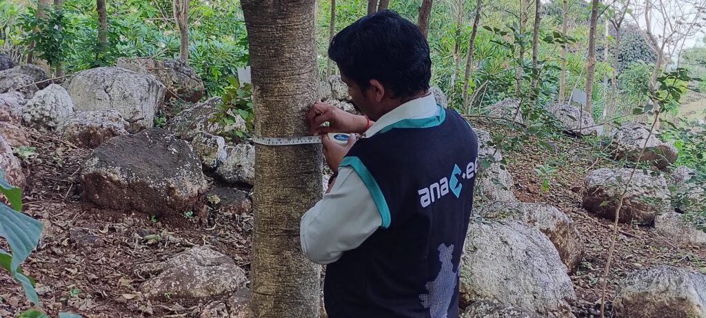
Ground-truth MRV: measuring tree diameter (DBH) to estimate carbon stock — each reading tied to a GPS location.
Drone maps the whole site
ground team measures & geo-tags trees
Orthomosaic + measurements on a live dashboard
overlaid on the real satellite map
Developer, buyer or auditor verifies from anywhere
Need verifiable MRV for your carbon project?
Anaxee flies the site, measures on the ground, and delivers GPS-tagged evidence as a live dashboard — across 540 districts.
Carbon buyers have grown wary. After years of headlines about credits that did not hold up, the market is tightening around integrity: a credit is only worth what can be verified behind it. That shift is good news for honest projects — and it puts a premium on evidence that anyone can inspect.
This is where transparency turns into trust. When a developer or a corporate buyer can open a dashboard and see the trees on the real satellite map, measured and dated, the project stops asking to be believed and starts letting itself be checked. Independent, geo-tagged MRV is also the strongest defence against the three things that sink a project’s credibility: over-claiming, double-counting and plantings that quietly failed. What is on the map is what gets counted — nothing more.
Where technology and AI change it
Anaxee delivers MRV as a tech product, not a stack of PDFs. Orthomosaics, GPS boundaries and geo-tagged ground measurements all live on a live dashboard the project and its auditors can open any time, from anywhere. AI assists the heavy lifting — counting and classifying trees, flagging anomalies on the imagery — while the field network supplies the ground truth that keeps the numbers defensible.
Tell us the project — location, area and what you need to prove — by form, WhatsApp or a call.
A real person calls back — our Indore team, within one working day.
We scope a pilot — one site flown, measured and ground-verified, delivered as a dashboard you can open yourself.
A 150+ person team in Indore and 40,000+ Digital Runners on the ground — your enquiry reaches people who map and verify sites every day, not an inbox that goes quiet.
Tell us about your project
Share the location and area — our team will get back within one working day.
Frequently asked questions
What is carbon project verification (MRV)?
MRV stands for measurement, reporting and verification — the evidence that shows a carbon project did what it claims. For forestry and afforestation that means proving the trees exist, where they are, how many survived and how much they have grown, so the carbon stored can be estimated and checked.
How do drones help with MRV?
A drone-built orthomosaic covers the whole site with GPS accuracy, so trees are counted and located across the entire project rather than extrapolated from a few plots — and the same site can be re-flown later and compared against the exact coordinates.
Do you verify on the ground too?
Yes. Aerial imagery is paired with on-ground measurement — species, diameter, height, survival and condition — captured as geo-tagged records. Drone plus ground truth together is far stronger evidence than either alone.
Can a buyer or auditor check the project remotely?
Yes. The orthomosaic overlays on the real satellite map and the measurements sit on a dashboard, so a developer, corporate buyer or auditor anywhere can inspect the evidence against the real world instead of relying only on a written report.
Do you issue or certify carbon credits?
No. Anaxee provides the field measurement, monitoring and ground-truth data — drone plus ground MRV — that projects and their auditors rely on. Certification and credit issuance are done by accredited registries and validators; we supply the verifiable evidence that stands behind it.
What kinds of projects is this for?
Afforestation and reforestation, agroforestry, plantation and restoration projects — and the corporates and funders buying or backing credits from them who want independent proof.
How much area have you mapped, and what does it cost?
Anaxee has drone-mapped 2,000+ hectares to date, delivered as GPS-accurate orthomosaics with live dashboards. Cost depends on site area, terrain, resolution and the depth of ground verification — book a short call for a number.
The bottom line
The carbon market is being rebuilt around one thing: evidence you can trust. A credit backed by trees nobody can find is worthless; a credit backed by a map anyone can open and a measurement anyone can re-check is exactly what buyers now want. Drone coverage plus on-ground truth, delivered as a live, GPS-tagged dashboard, is how a project earns that trust — and how India’s forests turn a climate pledge into carbon that actually counts.
Orthomosaic drone imaging gives every pixel a GPS coordinate. Overlaid on the real map, it lets a funder anywhere verify a climate or agri project on the ground — transparency that builds trust and shuts out fraud. Anaxee has mapped 2,000+ hectares.
Quick answer: An orthomosaic is a drone-built aerial map in which every pixel carries a real GPS coordinate. Overlay it on the actual satellite map and you can point to any spot and see exactly what is there — a tree, a crop, a problem. That turns a report you have to take on trust into something you can verify with your own eyes, from anywhere in the world.
About Anaxee
40,000+ Digital Runners · 540 districts · 26 states · 11,000+ pincodes of reach
★ Winner, National Startup Award (Govt. of India)Trusted by 350+ brands — incl. Mahindra & ITCIndia’s Reach Engine since 2016
Picture a company funding a plantation in rural Madhya Pradesh from an office in London, or an agri-commodity buyer checking the region it sources from. They face the same problem: they depend on what people on the ground tell them — and words in a report can be incomplete, optimistic, or simply wrong. The money flows on trust, and trust is exactly what is hardest to verify from a thousand miles away.
Orthomosaic drone imaging removes the need to just trust. It lets you see.
On the ground already
2,000+ hectares
mapped by Anaxee with drones — delivered as GPS-accurate orthomosaics and live dashboards
Real sites, flown and verified — turned into maps a funder can open and inspect for themselves.
Source: Anaxee drone-services delivery to date.
What makes an orthomosaic different
GPS on every pixel. A special drone flies the site and its captures are stitched into an orthomosaic — a single aerial map where every point has a true, measurable coordinate.
The whole site, not a sample. You see every corner of the plot, not a few plots extrapolated across the rest.
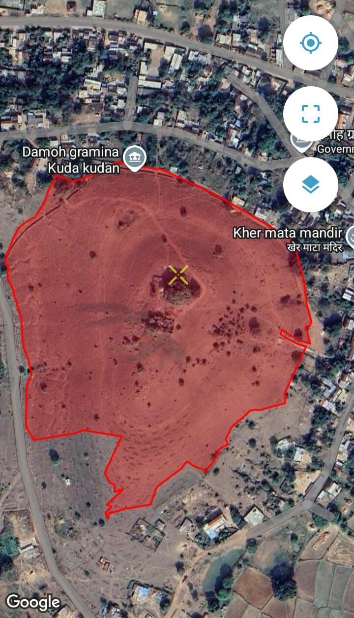
It overlays on the real map. Drop the orthomosaic onto the actual satellite map and anyone, anywhere, can line it up against the real world.
You see what is really there. Point at any spot and look — a tree, a crop, bare ground, a problem. There is nothing to take on faith.
It is repeatable. Fly the same site next season and compare against the exact same coordinates — so change, growth or loss is measured, not claimed.
Special drone flies the site
captures geo-referenced imagery
Stitched into a GPS-tagged orthomosaic
overlaid on the real satellite map
Anyone, anywhere, can verify the ground
Want your project visible and verifiable from anywhere?
Anaxee flies the site, builds the GPS-accurate orthomosaic, verifies it on the ground, and delivers it as a live dashboard — across 540 districts.
Why transparency turns into trust — and investment
When a funder can open a map and see the real ground, the whole relationship changes. Transparency produces integrity: the numbers are what the imagery shows, not what a report asserts. Integrity produces confidence: a buyer in Europe or the US can commit capital to a project in rural India because they can verify it, not just hope. And verifiability shuts the door on the thing everyone fears most — fraud and over-claiming — because an invented tree or a phantom plot simply does not appear on the map.
This is why orthomosaic mapping matters across so many fields at once: climate and carbon projects proving plantations are real and surviving; agricultural programmes checking what is actually growing where; and large agri-commodity and sourcing companies verifying the ground behind their supply chains and CSR commitments. In each case, the map is the independent referee everyone can trust.
Why drone plus fieldwork beats fieldwork alone
A mobile app with a geo-tagged photo is good — but it only ever shows the spots a person stood on. Drone imaging shows the whole site, and the ground team then verifies the detail the air cannot resolve — species, health, measurements. Aerial coverage plus on-ground truth is a far stronger proof than either alone, and dramatically stronger than fieldwork captured on an app by itself. That combination is exactly what Anaxee runs.
Where technology and AI change the game
Anaxee delivers this as a tech product. The orthomosaic, the GPS boundaries and the geo-tagged ground captures all land on a live dashboard the client can open any time, from anywhere. AI assists the analysis — counting, classifying and flagging anomalies on the imagery — while the field team keeps it honest with ground truth. The result is not a PDF that goes stale, but a living, inspectable record of the site.
Tell us the site — location, area and what you need to prove — by form, WhatsApp or a call.
A real person calls back — our Indore team, within one working day.
We scope a pilot — one site flown, mapped and ground-verified, delivered as a dashboard you can open yourself.
A 150+ person team in Indore and 40,000+ Digital Runners on the ground — your enquiry reaches people who fly and verify sites every day, not an inbox that goes quiet.
Tell us about your site
Share the location and area — our team will get back within one working day.
Frequently asked questions
What is an orthomosaic?
An orthomosaic is a single, geometrically-corrected aerial map stitched from many overlapping drone images. Because it is geo-referenced, every pixel corresponds to a real GPS coordinate, so distances and areas can be measured and any point can be located on the real map.
How does every image carry a GPS coordinate?
The drone records precise position for its captures, and the stitching process ties the whole orthomosaic to a coordinate system. The result is that any spot you click corresponds to an exact location on the ground.
How do you overlay it on Google Maps?
Because the orthomosaic is geo-referenced, it aligns directly onto the real satellite map — so the project boundary and what is inside it sit exactly where they are in the world, and anyone can compare them against the public map.
Can someone abroad verify a project remotely?
Yes — that is the point. A funder or buyer anywhere can open the dashboard, inspect the imagery against the real map, and see for themselves what exists on the ground, rather than relying only on a written report.
What kinds of projects is this for?
Climate and carbon projects (plantations, restoration, agroforestry), agricultural programmes, and large agri-commodity or sourcing companies verifying their supply chains and CSR — anywhere transparency and independent verification matter.
Why is drone plus fieldwork better than fieldwork alone?
A mobile app only captures the points a person physically visited. Drone imaging shows the entire site, and the ground team verifies the detail imagery cannot resolve — species, health, measurements. Together they are far stronger proof than either on its own.
How much area have you mapped?
Anaxee has drone-mapped 2,000+ hectares to date, delivered as GPS-accurate orthomosaics with live dashboards, and can scale across districts and states through its field network.
What does orthomosaic drone mapping cost in India?
It depends on site area, terrain, resolution and the depth of ground verification. Anaxee scopes it to your project — book a short call for a number.
The bottom line
Trust, in the end, comes from being able to see for yourself. An orthomosaic overlaid on the real map lets anyone — a funder in another country, an auditor, an agri-commodity buyer — look at a project and know what is actually there, down to the coordinate. That transparency is what builds integrity, and integrity is what unlocks confident investment and shuts out fraud. Paired with ground truth, it is the strongest proof a field project can offer.
Drone imaging counts and locates every tree; ground-truth runners verify survival and size. How carbon and afforestation projects in India prove their tree numbers instead of estimating them.
Quick answer: Counting and verifying trees across a plantation or restoration site used to mean sampling a few plots and extrapolating. Drone imaging plus ground-truth changes that — aerial orthomosaics count and locate the trees, field runners verify species, survival and growth on a sample, and the two reconcile into numbers a carbon registry or buyer can actually trust.
About Anaxee
40,000+ Digital Runners · 540 districts · 26 states · 11,000+ pincodes of reach
★ Winner, National Startup Award (Govt. of India)Trusted by 350+ brands & institutionsIndia’s Reach Engine since 2016
A carbon or afforestation project is a promise: this many trees, planted here, alive and growing. The whole value of the credit rests on that promise being true — and buyers, auditors and registries are increasingly unwilling to take it on trust. Yet traditional monitoring still counts a few sample plots and extrapolates across the whole site, with no spatial record and no way to prove survival. That gap is where credibility — and carbon revenue — leaks away.
Drone imaging paired with ground-truth verification closes it: you count what is actually there, and you prove it.
The tooling is ready
~18% a year
growth projected for India’s commercial drone market through FY29 — aerial survey has gone mainstream
The aerial imaging is cheap and accessible now. The hard part — and the differentiator — is pairing it with credible ground truth.
Source: commercial drone market forecast, via IANS
Why traditional tree counting falls short
Sampling and extrapolation. A few plots stand in for the whole site — fine until a buyer asks to see the trees that were never actually counted.
No spatial record. A spreadsheet of numbers cannot show where each tree is, so nothing can be re-checked or audited against the ground.
Survival is unverified. Trees planted is not trees alive. Without return visits, mortality is invisible — and it is exactly what registries scrutinise.
Over-claiming risk. Numbers that cannot be independently verified are the ones that fail due diligence — and damage a project’s reputation.
Not repeatable. Without a consistent, geo-located method, this year’s count cannot be compared to last year’s — so you cannot show growth over time.
Drone aerial imagery
counts & locates every tree
Ground-truth sample
runners verify species, survival, size
One verified, defensible dataset
Need to prove your tree numbers, not estimate them?
Anaxee pairs drone imaging with on-ground verification across 540 districts — every tree located, a sample verified, the whole site defensible.
A drone flies the site and stitches the captures into a geo-referenced orthomosaic — a single, measurable aerial map. From it, trees can be counted, located and their canopy measured across the whole plot, not just a sample.
Ground-truth verification
Field runners visit a statistically chosen sample and record each tree geo-tagged — species, survival, girth or diameter (DBH), and a photo. This is the on-ground reality that calibrates and validates what the aerial imagery sees.
Reconcile and flag
Aerial counts and ground samples are reconciled into one dataset, with discrepancies and anomalies flagged for re-check — so the final number is defensible and the method is transparent.
Repeat over time
Because every tree and plot is geo-located, the exact same site can be re-surveyed each season — turning a one-time count into a monitoring record that shows survival and growth, the way registries want to see it.
Fun fact: the number that matters in a carbon project is not how many trees were planted — it is how many are still alive and growing years later. Only a geo-located, repeatable method can show that, and that is exactly what drone-plus-ground-truth is built to do.
Where technology and AI change the game
Anaxee runs this as a tech product. Drone imagery and geo-tagged ground captures flow into a live dashboard with every tree and plot located on a map. AI assists the aerial count and flags implausible or off-plot captures, while the ground-truth sample keeps the model honest — so a project gets a verified, auditable record rather than a spreadsheet nobody can check. It is the same digital-MRV logic now central to high-integrity carbon markets.
Tell us the site — location, area and what you need counted or verified — by form, WhatsApp or a call.
A real person calls back — our Indore team, within one working day.
We scope a pilot — one site flown and ground-verified, so you see the method and the data quality before you scale.
A 150+ person team in Indore and 40,000+ Digital Runners on the ground — your enquiry reaches people who run field MRV every day, not an inbox that goes quiet.
Tell us about your site
Share the location and area — our team will get back within one working day.
Frequently asked questions
What is drone-based tree counting?
Using drone aerial imagery to count and locate trees across a whole site — stitched into a geo-referenced orthomosaic — rather than sampling a few plots and extrapolating. Paired with ground-truth checks, it produces a verifiable, spatial record of the plantation.
How is it more accurate than sampling?
Aerial imagery covers the entire site rather than a fraction of it, and a geo-located ground-truth sample calibrates the count — so the result is based on what is actually there, with a known margin, not an extrapolation from a few plots.
What is ground truth, and why does it matter?
Ground truth is on-site verification — runners physically checking a sample of trees for species, survival and size, each geo-tagged with a photo. It validates what the aerial imagery sees and is what makes the dataset defensible to an auditor.
How do you verify survival over time?
Because every tree and plot is geo-located, the same site is re-surveyed each season and compared against the baseline — so mortality and growth are measured, not assumed.
Can you measure DBH and tree size?
Yes — field runners record diameter (DBH), girth and height on the ground-truth sample, which feeds biomass and growth estimates alongside the aerial count.
Is this suitable for carbon registries and standards?
The approach follows the digital-MRV logic that high-integrity carbon standards increasingly expect — geo-located, repeatable, independently verified. The exact protocol is matched to the methodology your project uses.
How large an area can you cover?
From a single plantation to projects spread across districts and states — the field network spans 540 districts and 11,000+ pincodes, so geography is not the constraint.
What does drone tree verification cost in India?
It depends on site area, terrain and the depth of ground verification. Anaxee scopes it to your project — book a short call for a number.
The bottom line
In carbon and afforestation, an unverifiable number is a liability, not an asset. Drone imaging counts and locates every tree; ground truth proves they are real, alive and growing; and because it is all geo-located, you can show it again next year. That is the difference between a project a buyer trusts and one they walk away from.
Biochar Projects in India: From Soil Health to Marketable Carbon Removals — A Practical, No-Nonsense Guide for Developers and Buyers
Biochar can be a credible carbon-removal pathway and an agronomic input — but only if projects confront three messy realities head-on: (1) feedstock sourcing that avoids diversion or indirect emissions, (2) pyrolysis process control that guarantees carbon stability, and (3) soil carbon measurement that is conservative, repeatable and auditable. Buyers love the headline — “permanent carbon in the soil” — but verifiers and scientists will ask for lab analyses, decay-model transparency, and careful baseline/additionality. If Anaxee designs biochar pilots around traceable feedstock chains, validated pyrolysis lab certificates, conservative permanence factors, rigorous soil sampling and transparent benefit sharing, the credits will survive scrutiny and command a premium. If you shortcut any of these, expect pushback, discounting or reputational cost.
1. Why biochar? The promise, and the necessary skepticism
Biochar sits at a rare intersection: it can improve soil health, reduce nutrient/runoff losses, and lock carbon in a form scientists generally agree is more stable than uncharred biomass. That’s the promise. The skepticism is equally real: not all biochar is equal. The climate value depends on feedstock, pyrolysis temperature, residence time, and what happens to the biomass if not turned into char.
Key questions you must treat honestly from day one:
-What would the feedstock have been used for otherwise? (baseline displacement)
-Does producing biochar create a carbon debt in the supply chain? (collection, transport, drying)
-How stable is the char in your soil and climate? (decay rates vary)
-Are the agronomic benefits genuine and durable, or context-specific short-term gains?
These are not academic quibbles. They determine whether your credits are durable, additional and marketable.
2. What a biochar carbon project actually sells
Put simply: a biochar project sells carbon sequestration in a pyrogenic form — the fraction of carbon in the produced char that remains stable in soil for climate-relevant timescales (decades to centuries). Unlike tree planting (where permanence risks center on fire, harvest, land-use change), biochar permanence is about chemical stability and soil processes. You must convert a mass of feedstock into an auditable quantity of stable carbon, and then show that the soil retains it over time according to a conservative model.
There are two revenue streams (often intertwined):
Carbon removals credits — the quantified, conservative estimate of long-term carbon sequestered in soil due to biochar application.
Co-benefits monetisation (optional) — agronomic yield, reduced fertilizer need, water retention, local livelihoods; useful for impact buyers but must be evidence-backed.
Never oversell both simultaneously without rigorous evidence. Buyers will discount if agronomic benefits are speculative.
3. Feedstock: the core integrity issue
Feedstock choice is political, environmental and commercial. A project’s integrity rises or falls on whether feedstock sourcing causes direct or indirect emissions, food/forage competition, or land-use change.
Practical rules:
-Prefer waste residues: agricultural residues, processing waste, or invasive biomass that would otherwise rot, be burned openly, or require disposal. But don’t assume “waste” is free of competing uses — fodder, bedding, or brick kilns sometimes use the same residues. Document local usage.
-Avoid virgin wood from standing trees: converting live trees to char is almost never additional or acceptable.
-Traceability is mandatory: each feedstock batch should have a documented origin, weight, moisture content at intake, and a chain-of-custody record. Build simple field receipts with GPS and countersigned notes.
-Calculate opportunity cost: what the biomass would have been used for absent the project (baseline) must be defensible. If a residue is typically burned as fuel, turning it into biochar shifts emissions; if it was used as animal bedding, the analysis must capture that trade-off.
Don’t assume local communities won’t push back if residual value is expropriated; include stakeholders early in the feedstock policy and benefit-sharing plan.
4. Pyrolysis technology: temperature, yield, and stability
Pyrolysis — heating biomass in low-oxygen conditions — produces biochar, gases and bio-oil. The key control variables for carbon projects are:
-Temperature and residence time: higher temperatures typically increase aromaticity and carbon stability but reduce char yield per ton of feedstock. There’s a trade-off between quantity of char and its long-term stability. Projects must declare their operating point and justify how that maps to stability parameters.
-Process type: slow pyrolysis tends to yield more char; fast pyrolysis prioritises bio-oil. For carbon projects, slow, controlled pyrolysis is usually preferred for higher char yields.
-Char characterization: lab tests are mandatory. Measure fixed carbon fraction, volatile matter, ash content, aromaticity indicators (e.g., H/C ratio), and specific surface area (if claimed). These metrics feed into the decay model used in the PDD.
Operational imperatives:
-Use certified pyrolysis units with documented operating logs (temperature, feed rate, residence time). Don’t rely on “we ran it at ~500°C” claims without continuous monitoring logs.
-Retain representative char samples per batch and archive them for auditing. Randomly test samples in third-party labs to prevent bias.
-If your process lacks instrumented controls and archived logs, VVBs will treat your ex-ante carbon estimates with extreme scepticism.
5. How much carbon is stable? Measurement, modelling, and conservative accounting
This is the hard technical core for MRV teams: transforming a ton of biomass feedstock into an auditable amount of stable soil carbon.
Basic steps:
Mass balance at the plant: measure dry mass of incoming feedstock and output char mass (all on dry mass basis). Keep moisture logs.
Char carbon content: determine fixed carbon fraction (%) by lab analysis. Multiply output char mass × carbon fraction to get char C mass.
Stability fraction: not all char C is permanent. Apply a conservative stability fraction (the share of char C expected to remain in soil after the relevant time horizon). That fraction must be justified with lab data and literature; use conservative estimates accepted by registries.
Soil residence and fate: account for application loss pathways (runoff, erosion, ploughing depth changes) and any subsequent soil processes that can mineralise a portion of char C.
Two pragmatic rules:
-Use conservative stability factors in ex-ante claims (registries and buyers prefer lower, defensible numbers that survive scrutiny).
-Present sensitivity analyses: show best-estimate and conservative scenarios; buyers appreciate transparency and will prefer the conservative baseline.
Remember: verifiers will ask for the raw lab files, instrument calibration certificates, and chain-of-custody for samples.
6. Soil carbon measurement: sampling design and statistical basics
Counting soil carbon is expensive and error-prone if done badly. But it’s the gold standard for demonstrating real sequestration in situ, especially if you seek to show net soil C increases beyond the char carbon you applied (e.g., priming effects).
Design principles:
-Baseline sampling: collect soil cores across representative strata (soil type, cropping system, topography) before any application. Record depth increments (e.g., 0–10 cm, 10–30 cm). Baseline is non-negotiable.
-Control plots: where feasible, use randomized control plots (no-biochar) to detect non-biochar drivers of change. This strengthens additionality claims.
-Sufficient replication: soil C is spatially variable — sample sizes must produce confidence intervals that meet verifier requirements. Plan statistically (not heuristically).
-Standardised lab methods: use dry-combustion CHN analyzers for organic C determination; report uncertainty, detection limits, and QA/QC logs. Use the same lab and method across monitoring cycles.
-Re-sampling cadence: re-sample at conservative intervals — e.g., 1 year, 3 years, 5 years, depending on the registry and decadal permanence expectations. Soil carbon accrues slowly; don’t promise large near-term gains based solely on yield improvements.
If you cannot afford comprehensive soil sampling, you can still sell removals based on feedstock → char mass accounting with conservative stability fractions — but expect lower unit prices. Direct soil measurements command higher confidence and price if done well.
7. Additionality, leakage and co-impacts: the accounting perimeter
Biochar projects must pass the same additionality and leakage tests as other carbon projects.
-Additionality: demonstrate the biochar activity would not have happened without carbon revenue. This is tricky when small-scale entrepreneurs or agronomic experiments could scale without carbon finance. Build a clear financial model showing the project is not economically viable without carbon income (e.g., capital for pyrolysis units, logistics, or farmer incentives).
-Leakage: could using residues for char divert them from alternative uses, forcing replacement biomass harvesting elsewhere? Estimate such indirect effects and, if material, apply leakage deductions or buffer credits. Document assumptions transparently.
-Non-GHG co-impacts: soils can benefit (yield, water retention) or sometimes suffer (if char contains contaminants or changes soil pH). Monitor for unexpected negative impacts and include them in your social and environmental safeguards.
Don’t rely on wishful thinking. Verifiers will probe the baseline counterfactual and whether the project creates displacement of existing resource uses.
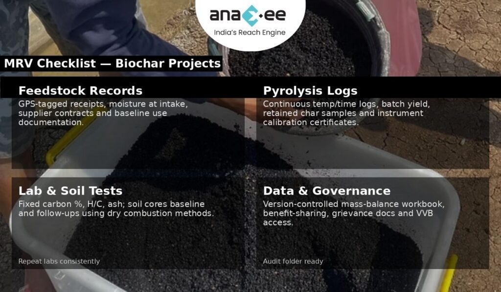
8. MRV practicalities: what your verification folder must contain
If you want a VVB to pass on first review, prepare this folder — it’s not optional:
-Soil sampling files: baseline and follow-up core sample IDs, GPS, depth logs, lab results, and QA/QC checks.
-Mass-balance spreadsheet: raw data with calculations from feedstock dry mass → char mass → char C → stable C with clearly shown formulas. Maintain version control and preserve raw files.
-Project governance & community consent: feedstock access agreements, benefit sharing, and grievance mechanism records.
-Model documentation: the decay model and literature justification for chosen stability fractions and any factors applied.
If any of these elements are missing or poorly documented, the VVB will increase uncertainty factors or reject claims.
-Capital: pyrolysis units (from small mobile kilns to fixed industrial units). Quality, instrumented units cost more but provide audit trails.
-Feedstock logistics: collection, drying, grinding, transport. Moisture reduction is often a hidden cost — wet feedstock lowers yield and increases energy needs.
-Lab testing: batch char characterization and soil sample analysis. These are recurring and non-trivial.
-Soil sampling & MRV: field teams, coring equipment, transport, and lab costs.
-Operations & management: local teams, data processing, inventory systems.
-Verification & registry fees: VVB cycles and registry issuance costs.
-Buffer and contingencies: for permanence risks, leakage or lower-than-expected stability.
Do not underprice MRV and lab testing. They are the marginal cost that determines whether credits survive validation.
10. Commercialization: who buys biochar credits and why
Buyer demand varies. Typical buyer types and their motivations:
-High-integrity removals buyers (tech firms, net-zero pledgers): they want conservative, well-documented removals they can confidently book against targets. They will pay a premium for verifiable soil carbon with rigorous MRV.
-Impact buyers: NGOs or corporates interested in soil health and livelihoods may buy projects with demonstrable co-benefits even if carbon prices are modest.
-Commoditised buyers: traders looking for volume may accept lower MRV rigour at a discount; these are riskier counterparties.
Packaging matters: deliver small digital dashboards with char mass flows, archived lab files, and anonymised soil result extracts to high-integrity buyers. They will ask for chain-of-custody and may request spot re-tests.
11. Common pitfalls and how to avoid them
Be direct: many projects fail on avoidable errors. Avoid these:
-Weak chain-of-custody: failing to document feedstock origin exposes you to leakage accusations. Fix: standard receipts + GPS + supplier contracts.
-Poor pyrolysis controls: hand-built kilns without logs make stability claims impossible to justify. Fix: instrumented units and archived run logs.
-Insufficient soil sampling: tiny sample sizes produce wide confidence intervals and unreliable claims. Fix: consult a statistician and build a representative sampling frame.
-Over-claiming co-benefits: yield improvements are context-dependent; don’t promise what you can’t prove. Fix: conservative claims and pilot data.
-Ignoring community impacts: feedstock extraction can create local grievances if not consented and compensated. Fix: explicit benefit sharing and FPIC where applicable.
Shortcuts increase audit friction and ultimately lower project value.
12. Project design template — from pilot to program
Here is a practical stepwise blueprint Anaxee can replicate.
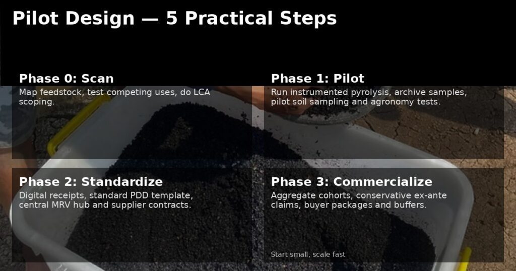
Phase 0 — Feasibility & stakeholder scan
-Map feedstock availability, current uses, and competing markets.
-Test community sentiment on feedstock use and land rights.
-Conduct an initial LCA scoping to identify high-risk upstream emissions.
Phase 1 — Pilot (replicable, data-centric)
-Install a pilot pyrolysis unit with full instrumentation.
-Produce char at controlled settings; archive samples.
-Run a small soil sampling regime (pilot control vs treated plots).
-Measure agronomic outcomes and perform preliminary farmer interviews.
-Build mass-balance spreadsheets and model stability fractions conservatively.
Phase 2 — Scale (standardise and govern)
-Standardise feedstock receipts and supplier contracts.
-Deploy certified pyrolysis units and train operators.
-Implement a central MRV hub for data ingestion, char archiving, and soil sample management.
-Create a benefit-sharing mechanism linking feedstock suppliers and smallholders to revenue streams (not just promises).
-Engage VVB early with pilot data to align monitoring expectations.
Phase 3 — Program & commercialization
-Aggregate across sites, harmonise PDD documentation and governance.
-Price credits transparently accounting for buffer pools for risk.
13. PDD & MRV language: audit-ready clauses
Objective (sample):
“Quantify the amount of pyrogenic carbon sequestered in agricultural soils through application of conventionally produced biochar, using a conservative, auditable mass-balance approach (feedstock dry mass → char mass → char C → stable C) complemented by soil sampling for a subset of plots. All laboratory certificates, plant run logs, and chain-of-custody documentation will be retained in the project MRV repository and made available to the VVB.”
Monitoring approach (sample):
“Mass flow monitoring will record dry feedstock intake, char output mass, and batchwise char sampling for laboratory determination of fixed carbon. Soil cores from stratified representative plots (treatment and control) will be collected at baseline, Year 1, Year 3 and Year 5 and analysed using dry combustion. Ex-ante stable fraction assumptions will be conservative and justified with third-party lab tests and literature.”
Use these as starting points and make your numbers conservative.
14. Anaxee’s competitive playbook — where you must get ruthless
Anaxee’s strengths (local teams, dMRV, last-mile execution) can make biochar commercially viable — but execution must be ruthless about documentation.
Concrete moves:
Invest in one well-instrumented pilot: purchase a quality slow-pyrolysis unit with data logging; get char samples tested in reputable labs. This single pilot will define your PDD parameters.
Standardise receipts and digitalise the supply chain: use simple mobile forms for supplier receipts with GPS and photos to create tamper-resistant evidence.
Build a central MRV hub: ingest run logs, lab files, soil data and generate audit packs automatically. This reduces VVB time and fees.
Offer a transparent benefit-share to suppliers: a fair, quick payment mechanism prevents grievances and secures feedstock.
Pitch conservative credits to high-integrity buyers first: premium buyers will help establish price anchors.
Don’t try to be everything at once. Do one well-documented project, prove the model, then scale.
15. Hypothetical case study: a replicable pilot model
Context: Agro-processing clusters producing cassava/peanut shells in two districts, residues currently burned or left to rot. Pilot size: 3,000 t/year feedstock capacity; expected char yield 15% dry mass. Key controls: instrumented slow-pyrolysis unit, char batch archiving, lab char characterization, baseline soil sampling on 100 farm plots (50 control, 50 treatment). Economics: feedstock payments to suppliers, capex amortised over 7 years, MRV and lab testing funded by early carbon forward sales at conservative price. Risk mitigation: buffer pool allocation (5–10%), supplier contracts with grievance redress, drying yards to reduce moisture costs.
Outcome: conservative ex-ante carbon claim based on char mass × fixed C × conservative stability fraction; soil sampling used to validate and, over time, potentially increase confidence intervals and raise crediting volumes.
16. Buyer due diligence checklist (what buyers will ask)
Buyers who pay for removals will insist on:
-Mass-balance spreadsheet with raw feedstock & char logs.
-Laboratory certificates for char and soil analyses (with QA/QC).
-Chain-of-custody receipts for feedstock with GPS evidence.
-Pyrolysis run logs (temperature/time).
-Baseline, control plots, and soil sampling plan showing statistical adequacy.
-Evidence of supply-chain consent and benefit sharing.
If you can’t produce these in the first 72 hours, you will struggle to close quality buyers.
17. Ethics, community and co-benefits — don’t treat them as marketing copy
Biochar projects intersect livelihoods. If you extract biomass from smallholders without fair compensation, or if you promote feedstock diversion from animal bedding to char, you erode trust and create perverse outcomes. Document how suppliers are chosen, paid, and how their livelihoods are protected.
Co-benefits must be proven:
-Measure yield changes with randomized or matched control plots.
-Test soil health indicators (Cation Exchange Capacity, pH, available nutrients) for plausible agronomic claims.
-Be transparent about where biochar worked and where it didn’t — buyers appreciate honest reporting.
18. Final reality check — be conservative and transparent
Biochar is attractive. But the market will reward projects that are disciplined and transparent, not those that promise untested miracles. The correct posture is humility: treat ex-ante estimates as conservative hypotheses backed by lab and pilot data, not marketing copy. Buyers and verifiers will respect conservatism and clear audit trails.
If Anaxee wants to lead in biochar:
-Start with one instrumented pilot.
-Build standardised digital receipts and a central MRV hub.
-Use conservative stability fractions and publish sensitivity analyses.
-Prioritise feedstock traceability and supplier fairness.
-Engage a reputable VVB early with pilot data to align expectations.
Biochar can be both an effective soil amendment and a credible removal pathway — but only when the proofs are in the data, and that data is auditable.
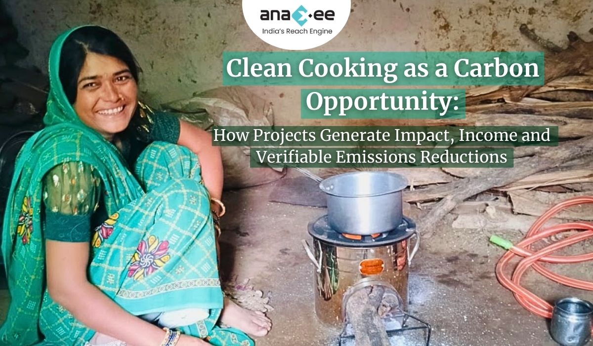
Clean-cooking projects can produce high-integrity emission reductions (ERs) only when developers solve three hard problems together: a defensible baseline, objective evidence of sustained adoption (not just distribution), and an audit-grade MRV system. Newer methodologies and MRV guidance now favour metered and sensor-backed approaches (VM0050, Gold Standard’s metered methodology, and Clean Cooking Alliance templates). Ignore this shift — rely on surveys alone — and your credits will be risky, discounted, or invalidated. If Anaxee designs projects around measurable sustained use (SUMs + meters), solid additionality evidence (especially in India’s PMUY context), and conservative accounting, the results are bankable and valuable to buyers.
1. Why clean cooking still matters (and why carbon finance is useful)
Around the world, billions cook on polluting fuels (wood, charcoal, dung, kerosene). The harms are multiple: household air pollution and associated health burdens (disproportionately on women and children), time lost collecting fuel, pressure on local biomass stocks, and greenhouse gas emissions from inefficient combustion. In India, policy has massively expanded LPG access through programmes like Pradhan Mantri Ujjwala Yojana (PMUY), but access frequently does not equate to exclusive or sustained use — stove-stacking (using multiple cook technologies) is common. That gap — converting access into sustained clean-fuel use — is precisely where targeted carbon finance can help by underwriting behaviour-change, refills affordability, or technology maintenance. But funds must be tied to measurable, verifiable outcomes.
2.What clean-cooking carbon projects are actually selling
These projects sell avoided emissions — reductions in GHGs compared to a baseline where households continue to use more carbon-intensive fuels or inefficient stoves. Important clarifications:
-These are not carbon removals; permanence concerns are about sustained use, not geological storage.
-Credibility rests on additionality (would the reduction have happened without the project?), accuracy (are the reductions measured correctly?), and traceability (is there a clear audit trail of evidence?).
-Standards now require higher measurement fidelity; metered and stove-sensor approaches are fast becoming the preferred path for high-integrity claims.
3. Major project archetypes and their measurement implications
Not every cookstove project is the same. Each model has distinct MRV needs and transaction costs.
Improved biomass cookstoves (ICS) — cheaper hardware replacing open fires. MRV challenge: objectively proving sustained use, since distribution often vastly overstates actual emission reductions.
Fuel-switch projects (LPG, electricity, biogas) — replace biomass/fossil fuels with cleaner fuels. MRV challenge: demonstrate sustained fuel consumption (refill frequency, electricity kWh, or biogas production/use). Metering/purchase logs are high-value evidence.
Advanced biomass & pellets — require supply-chain documentation to ensure feedstock sustainability and avoid leakage.
Community-scale biogas — methane capture + use; MRV must quantify substitution versus baseline manure handling and open-fire use.
Higher measurement fidelity (meters, SUMs) usually increases costs but reduces uncertainty and raises buyer confidence — and thus price.
4. Baseline and additionality: the real accounting work
Baselines capture the counterfactual — what households would have done absent the project. With stove-stacking common, a naive baseline (e.g., “this household had a smoky stove”) is not enough. Typical baseline approaches:
-Survey-based baseline: household-reported fuel use and stove types. Cheap but prone to social-desirability and recall bias.
-Observed baseline: enumerator observation of stove type and fuel stores. Useful but limited for quantifying hours-of-use.
-Metered baseline: where possible (LPG refills, electricity meters), provides objective consumption history. Preferred when feasible.
Additionality in India is the hard edge-case because PMUY and related subsidies have changed the policy landscape. PMUY has delivered tens of millions of LPG connections — the program data show very large coverage and rising refill rates — which means carbon projects must demonstrate additional behaviour (e.g., increased refill frequency, bridging affordability gaps, stimulating exclusive use, or targeting households not reached by government programmes). Relying on distribution of an LPG cylinder alone without proving sustained refills will not pass muster. Use government data to justify your additionality assumptions and be conservative.
5. The MRV reality: what verifiers now expect
Standards (Verra, Gold Standard) and the Clean Cooking Alliance have moved decisively toward objective measurement. The key MRV components every credible project must have:
5.1 Stove Use Monitors (SUMs)
SUMs — small temperature/data loggers affixed to stoves — objectively record stove usage events and durations. They are the most defensible way to demonstrate ongoing use for non-metered stoves. Deploy SUMs on a statistically valid, stratified sample and combine with surveys to extrapolate to the whole cohort. SUMs help detect a Hawthorne effect, tampering, and temporal adoption patterns. Clean Cooking Alliance protocols explicitly recommend SUMs as best practice for usage verification.
5.2 Metered approaches for fuel-switch projects
For LPG or electrical cooking projects, purchase records, cylinder refill logs, or electricity meters are the best evidence. Gold Standard’s metered methodology and Verra’s VM0050 explicitly recognise and prefer metered data where feasible because it significantly reduces uncertainty. If you operate in a PMUY context, work with refill retailers or LPG OMCs to access anonymised refill frequency data for beneficiaries where possible.
5.3 Surveys, KPTs and CCTs
Kitchen Performance Tests (KPTs) and Controlled Cooking Tests (CCTs) remain useful for labelling device efficiency and translating device performance into fuel savings under controlled conditions. But field-level sustained use needs SUMs/meter evidence, backed by representative household surveys capturing stacking behaviour and qualitative reasons for non-use. Standards increasingly require the mixed-method approach: sensors + surveys + purchase records.
5.4 Sampling design and QA/QC
Design your sampling to meet verifier confidence thresholds. Use stratified random sampling by socio-economic status, geography, household size, and initial baseline stove/fuel type. Train enumerators intensively, keep GPS-tagged photos, and maintain raw data files with version control. Verifiers will demand original SUMs logs, raw survey forms, enumerator training records, and a documented data cleaning process — so treat data management as a compliance function, not an afterthought.
6. A practical MRV protocol (copy-paste-ready checklist)
This is operational — adopt it and modify per project specifics.
-Annual reporting thereafter; scheduled SUMs redeployments for sample refresh every 18–24 months.
Data to collect
-Raw SUMs temperature logs (time-stamped).
-Fuel purchase/refill receipts or utility meter logs.
-Household survey results (baseline and follow-ups).
-Pictorial proof (GPS-tagged photos) and enumerator visit logs.
-Device serial numbers, beneficiary registry, installation logs.
Quality assurance
-Double-entry or automated ingest from SUMs into central repository.
-Supervisor spot-check on 10% of visits.
-Tamper-detection (SUMs battery/connection checks) plus periodic device recalibration.
-Maintain an audit folder with all raw and derived files for VVB access.
Use this as your MRV spine and then add PDD-specific formulas, e.g., substitution factors, emission factors, and conversion tables.
7. Risk, integrity, and the reputational minefield
Cookstove carbon credits faced strong academic and media scrutiny for overstated claims in the past. That scrutiny forced standards bodies and the Integrity Council (ICVCM) to raise the bar — rejecting simplified, survey-only methodologies and favouring metered/measured approaches. If your project relies on distribution records or optimistic usage assumptions without sensor or meter backing, expect deep discounting or rejection by high-integrity buyers. Conservative accounting and transparent evidence are not optional — they are business hygiene.
Common failure modes and countermeasures:
-Distribution ≠ use: countermeasure — conditional payments tied to verified use (SUMs/meter evidence).
-Double-counting with government programmes: countermeasure — explicit PDD documentation showing how your intervention goes beyond government provision (e.g., refill subsidies, maintenance, user training targeting refill behaviour).
-Sample bias and social desirability: countermeasure — objective sensors, independent enumerators, and careful sampling.
-Under-budgeting MRV & VVB costs: countermeasure — model verification cycles early and build VVB engagement into project timelines and budgets.
8. Operational blueprint: from procurement to verified credits
A carbon-grade cookstove programme is first and foremost an operational delivery challenge. Below is a sequence that reduces MRV friction and raises buyer confidence.
Pilot and acceptability testing: test device fit for purpose (user ergonomics, fuel needs, cooking styles). Document pilot KPTs/CCTs and field user feedback.
Procurement & performance certification: procure devices with lab performance certificates (WHO or Clean Cooking Alliance ratings). Retain test reports and device warranty info.
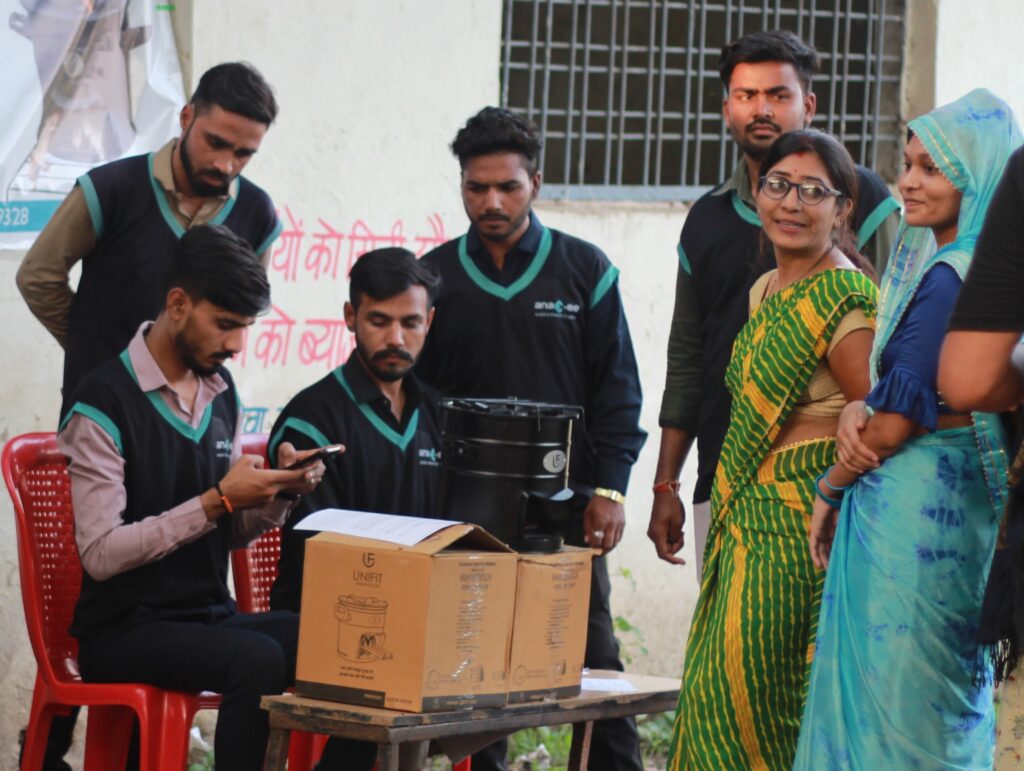
Beneficiary registry and unique IDs: register beneficiaries with GPS, ID, device serial numbers, and signed consent forms. This registry is the backbone of traceability.
Distribution + user training: ensure each household receives hands-on training. Capture attendance and photo proof.
MRV deployment: deploy SUMs/metering devices on a validated sample and collect baseline purchase/consumption evidence. Keep raw files in a version-controlled repository.
Post-distribution follow-up & maintenance: scheduled visits at 3, 6, 12 months with maintenance support. Use conditional incentive payments to encourage verified use.
VVB engagement & pre-audit: bring in an independent verifier early to review MRV protocols and pilot data — this reduces rework at validation.
If any of these steps are skipped, you increase risk of audit friction and potential invalidation.
9. Budget reality check (be conservative)
Many projects misprice themselves by underestimating MRV and verification costs. A realistic split:
-Hardware & distribution: 40–55%
-Behaviour-change & after-sales: 10–20%
-Monitoring & MRV (incl. SUMs/metering): 10–25%
-VVB & verification cycles: 8–15%
-Programme management & contingency: 5–10%
If you trim MRV to save costs, you will likely lose more in discounts or failed validations. Build MRV and VVB costs into the unit economics up front.
10. Commercialisation: what buyers will and won’t pay for
Buyers have become pickier. What commands a premium:
-Conservative, sensor-backed ERs. Sensors/metering reduce uncertainty and attract quality buyers.
-Transparency & audit trails. Raw SUMs logs, sample survey files, and enumerator training records available on request.
-Co-benefit evidence. Documented health outcomes, time savings, and gendered benefits enhance buyer interest in impact-oriented portfolios.
-Additionality clarity. Show how the project adds beyond government programmes (e.g., refill affordability or exclusive-use incentives where PMUY provided hardware).
Buyers will discount or avoid projects that rely exclusively on distribution or surveys and cannot produce raw sensor/meter files.
11. Aggregation & programme-based registration: scale without losing discipline
Small projects are uneconomic if each carries full VVB costs. Aggregation (pooling multiple small interventions under a programme approach) makes sense — but governance is everything: who signs sales contracts, how are revenues split, and how is the MRV protocol consistently enforced across geographies? Registries support programmatic registration, but you must standardise PDD templates, a central MRV repository, and a single governance charter for subprojects. Do this well and you lower per-credit costs and increase buyer appetite.
Use these clauses to speed PDD drafting and reduce back-and-forth with verifiers.
Monitoring objective (sample)
“The project quantifies sustained adoption of Project stoves and fuel-switch behaviour using a mixed-method monitoring system combining Stove Use Monitor (SUMs) data from a stratified, representative sample, fuel purchase/refill records where available, and annual socio-economic household surveys. All raw SUMs logs, survey instruments and enumerator training materials are retained in the project MRV repository and made available to the VVB upon request.” Clean Cooking Alliance
Additionality rationale (sample)
“The project targets households that, despite receiving connection under national programs, demonstrate low refill frequency and high stove-stacking. By providing targeted refill affordability support, user training, and maintenance incentives that exceed government program provisions, the project increases sustained use of clean fuel — thereby producing measurable additional emission reductions.” (Cite PMUY coverage and refill trends.)
Use conservative factors and avoid optimistic extrapolations.
13. A compact Anaxee playbook — what to do next (practical & unapologetic)
If Anaxee wants to scale credible clean-cooking credits in India, focus on:
Design for measurement: pick technologies and distribution models that support metering or reliable SUMs deployment. Meter when you can; use SUMs when you can’t.
Solve refill economics: in PMUY contexts, the marginal gain is sustained refills. Design top-up/subsidy interventions tied to verified refill behaviour.
Build a central MRV hub: centralise data ingestion, cleaning, and audit folders. Train enumerators thoroughly and maintain version-controlled raw data.
Aggregate from day one: standardise PDD templates and MRV protocols so small cohorts can be pooled under a single program.
Conservatism & transparency: err conservative in ex-ante estimates; publish methodological choices and make samples available to buyers.
Be brutal about quality control: it’s cheaper to do MRV properly than to defend inflated claims later.
14. Hypothetical pilot: a design you can replicate
Target cohort: 10,000 rural households across two districts with demonstrable low refill frequency. Intervention: partial LPG refill subsidy for 12 months + intensive behaviour-change + SUMs on a 10% representative sample. MRV plan: baseline SUMs + survey; SUMs redeployment at 6 and 12 months; monthly refill logs for the cohort from retail partners where feasible; independent verification at 12 and 24 months. Commercial packaging: conservative ex-ante ERs, buyer quarterly reporting with access to anonymised SUMs sample, and a 5–10% buffer for programme risk.
This pilot balances costs and credibility and produces a buyer-friendly evidence package.
15. Buyer due diligence checklist (for corporates)
Before you sign a purchase agreement, demand:
-Raw SUMs files for representative monitoring windows and a sample of cleaned extracts.
-Clear additionality evidence against national/local programmes (e.g., PMUY stats and how the project adds to those).
-Benefit-sharing and grievance redress mechanism documentation.
-Sample verification report from a VVB and contactable references.
-Evidence of supply-chain sustainability if biomass/pellets are used.
If a developer can’t provide these, discount the credits or walk away.
16. Closing reality check (no marketing spin)
Clean cooking is high-impact and can produce high-integrity ERs — but only if project developers stop treating carbon income as a rebate on distribution costs. The market has shifted. Standards and buyers now reward measurement (metering and SUMs), conservatism, and transparency. Anaxee’s operational strengths — local field teams, dMRV capacity, and experience in community engagement — are exactly the assets needed to execute credible programs. But execution must prioritise MRV funding and discipline. Skimp on monitoring and you’ll pay later in auditor delays, discounts, or stripped credits.
Connect with us at sales@anaxee.com
Agroforestry that Pays: Practical Guide to High-Integrity Bund & Smallholder Plantation Projects (VM0047-ready)
Agroforestry isn’t a feel-good sidebar to climate policy — it’s one of the few Nature-based Solutions already proven to deliver measurable carbon removals while generating local income and soil resilience. But turning plots into verified carbon credits requires more than tree-planting zeal. The difference between a project that sells quality credits and one that stalls under validation is in the design, documentation, monitoring, and benefit-sharing structure. This is a practical, no-nonsense guide to designing VM0047-style agroforestry projects (including bund plantation models for smallholders), with a focus on how Anaxee’s implementation + MR capabilities translate theory into bankable credits.
1) Start here: pick the right intervention and scale
Agroforestry projects range from alley cropping and boundary planting to large afforestation parcels. For smallholder bund plantations (a common model in South Asia), the practical strengths are:
-Low entry costs and high social co-benefits (shade, fodder, fruit, erosion control).
-Easier parcel-level measurement when plots are small and ownership is clear.
-Clear integration with cropping calendars so farmer livelihoods are not disrupted.
But selection must be strategic. Ask: are parcels contiguous enough to use pooled sampling? Are land rights clear? Is there an existing extension network to deliver seedlings and training? The manual stresses early documentation of land tenure and legal evidence — do not skip this. Land title and carbon-asset ownership will be scrutinized during validation.
2) The PDD checklist: what validators want to see (and what developers routinely get wrong)
Validation bodies and methodologies require precise, consistent documentation. The manual includes a practical PDD checklist — use it as your playbook. Key PDD elements that must be tight:
-Project overview: clear title, coordinates, developers, start date, and crediting period. Ambiguity here invites long review cycles.
-Eligibility & methodology: explicitly cite the chosen standard and justify methodology applicability (e.g., VM0047 for afforestation/reforestation/revegetation approaches). If using VM0047, demonstrate how your planting model maps to methodology definitions.
-Baseline and additionality: provide robust reasoning for why the activity wouldn’t occur in the absence of carbon revenue. For bund plantations on smallholder plots, baseline arguments must consider existing farmer incentives and local extension programmes.
-Leakage & permanence: identify local drivers of deforestation/land conversion and present leakage mitigation (e.g., buffer pools, landscape-level measures). Permanence risks must be quantified and addressed (insurance, buffer credits).
-Legal & benefit sharing: land title evidence, benefit sharing agreements, and FPIC/consultation records are not optional — they’re central to project integrity. Have contracts ready.
Two mistakes I see repeatedly: (1) sloppy, inconsistent numbers across tables/maps (double-check everything), and (2) treating the PDD like marketing copy. Keep it succinct and evidence-based. The manual explicitly recommends concise PDDs with tables/graphics for clarity.
3) Methodology and measurement choices (VM0047 in practical terms)
VM0047 (afforestation, reforestation and revegetation frameworks and similar approaches) is widely used for tree-planting projects because it provides clear rules on baseline setting, growth curves, carbon pools, and monitoring periods. Practical consequences for an Anaxee bund-plantation project:
-Carbon pools to include: Aboveground biomass is the primary pool; depending on methodology, belowground and soil may need treatment or exclusion. Be explicit in your PDD which pools are modelled and why.
-Ex-ante estimates: your model must be defensible — include growth curves, species parameters, and mortality assumptions. The manual highlights ex-ante vs ex-post treatment and warns that ex-ante estimates must be conservative and justified.
-Sampling design: smallholder mosaics typically require stratified sampling and a mix of remote sensing and plot inventories. Design sample sizes to meet verifier confidence levels — don’t downsize to save costs and then fail verification. The manual recommends combining field plots with remote sensing where possible.
4) Implementation: the operational reality (planting, survival, costs)
Planting is where theory meets human behaviour. Bund plantations need simple, farmer-friendly protocols:
-Species selection: prefer natives or locally proven fast-growing agroforestry species that deliver both carbon and livelihood benefits (fruit, fodder, fuelwood) — this helps uptake and survival.
-Nursery & seedling logistics: centralize seedling production to ensure quality and uniformity. Stagger planting windows to match monsoons and cropping cycles.
-Survival and maintenance: establish a 2–3 year maintenance plan with scheduled visits, fertilization (if applicable), and pest control. Mortality assumptions in the PDD must reflect on-ground survival plans.
-Costs and payment schedules: link farmer incentives to milestones (e.g., survival checks at 6, 12, 24 months). Upfront seedling provision with partial co-funding from farmers can reduce moral hazard but be designed sensitively.
Operational discipline reduces non-permanence risk, lowers verification disputes, and makes credits marketable.
5) Monitoring & MRV that survives scrutiny
Monitoring separates credible projects from wishful thinking. The manual gives practical guidance on what monitoring plans must contain: indicators, data sources, frequency, and protocols. Treat the monitoring plan as the operational manual for your VVB and auditor.
Core MRV components for bund/smallholder agroforestry:
-Carbon indicators: tree survival, DBH/height measurements (or appropriate proxies), species identification.
-Non-carbon indicators: land use change, crop yields, livelihood impacts, SDG co-benefits (useful for buyers who want co-benefit claims).
-Data sources: field plots (stratified), farmer logs, mobile data collection, and satellite imagery for change detection and leakage monitoring. The manual strongly recommends local partner training and simple digital collection tools to scale monitoring while controlling costs.
-Monitoring frequency: at minimum annual carbon monitoring for the first verification cycles; more frequent socio-economic monitoring is recommended in the early years. The manual’s PDD checklist flags the need for a monitoring protocol describing how data will be collected and analysed.
Practical MRV tips (Anaxee’s edge):
-Use mobile forms and GPS-tagged photos at each plot visit to make audits painless.
-Store raw data and derived metrics in a consistent directory structure and maintain a change log — verifiers hate ‘missing original data’. The manual stresses documenting all data sources and assumptions.
6) Social safeguards & benefit sharing — not a checkbox exercise
Carbon projects get audited for social safeguards now as rigorously as for carbon numbers. The manual lays out expected ESG materials: evidence of consultations, FPIC where applicable, gender inclusion, expected livelihood impacts, grievance redress mechanisms, and detailed benefit-sharing plans. These are required elements for registration and market acceptance.
A few hard truths:
-sharing needs simplicity: complicated formulas bury the true winners and frustrate communities. Flat rates tied to milestones or a clear split of monetized credit revenues are easier to administer and verify.
-FPIC & consultation records: keep minutes, sign-offs, and clear communication materials in local language. Document the process; photos and attendance lists help.
-Grievance redress: a named local contact and response timelines are minimum requirements. Auditors will probe whether the mechanism works in practice.
7) Commercialization: who buys these credits and at what price?
Nature-based credits are facing higher scrutiny; buyers want quality, traceability, and co-benefits. The manual’s commercialisation section highlights two practical points: sellers must do due diligence on buyers and price expectations must cover real project costs (including verification and buffer).
Market reality for smallholder agroforestry credits:
-Quality premium: well-documented projects with credible MRV and social safeguards command a premium.
-Blue vs green demand: buyers seeking removals and nature co-benefits prefer projects that demonstrate durable sequestration and strong social outcomes.
-Transaction costs: smaller projects face proportionally higher transaction costs — consider aggregation models (pooled projects under one PDD) to spread VVB and verification costs. The manual references pooling and mosaic approaches used in other NbS contexts.
8) Pitfalls and how to avoid them (real world)
I’ll be blunt: many agroforestry carbon projects fail verification on preventable grounds. Here’s what trips teams up and how to address it:
-Inconsistent documentation: numbers in the PDD, monitoring spreadsheets, and maps must match. Fix: a single source of truth (master spreadsheet + version control). The manual explicitly warns to “be consistent”.
-Under-budgeting verification & VVBs: VVB availability is constrained; engage early and build relationships. The manual suggests securing a VVB early in development.
-Weak local buy-in: if farmers see no short-term benefit, survival suffers. Fix: tie incentives to outcomes and offer clear livelihood co-benefits (fodder, fruit).
-Land tenure ambiguity: unresolved title disputes can derail validation. Fix: obtain documented evidence of land use rights or formal agreements.
9) Scaling strategy: aggregation, registries and programme design
If your ambition is scale, plan for aggregation from day one. The manual highlights landscape/mosaic approaches and suggests programmatic registration options where applicable. Aggregation reduces per-credit transaction costs and improves marketability, but requires rigorous governance (who signs sales contracts; how are revenues pooled?).
You asked me to be frank. Here are where an implementation/MR firm like Anaxee can actually change outcomes — or fail to, if poorly executed:
-Get the PDD right: Anaxee’s field footprint and experience with smallholder engagement reduce practical PDD failure modes (consistency, data quality). The manual stresses local engagement and documentation as credibility drivers.
-dMRV & local teams: training local enumerators and using mobile collection reduces verification time and cost. The manual recommends partnering with local institutions and training communities for monitoring.
-Commercial acumen: many NGOs can plant trees; fewer can package IP and MRV into sellable, audited credits. The manual’s commercialization checklist is a useful reference for negotiating buyer terms and conducting due diligence on buyers.
If Anaxee wants to lead, focus on: standardising PDD templates, building modular MRV stacks, creating clear farmer contracts, and developing a transparent accounting dashboard for buyers.
11) Tools & templates I recommend you publish (and use)
From the manual’s practical orientation, these are the templates that speed validation and increase buyer confidence:
Publishing these (or portions) on Anaxee’s site as downloadable resources will help buyers and partners assess project maturity quickly.
12) Closing: a reality check for buyers & developers
If you’re a corporate buyer: insist on seeing the monitoring protocol, benefit-sharing agreements, and proof of land rights before committing. Don’t buy on glossy images alone.
If you’re a developer: never let fundraising timelines compress the validation process — rushed projects create stranded credits and reputational loss.
The Eastern-Africa manual we used as a reference is pragmatic: it shows the pathway from concept to commercialization and calls out the non-negotiables — legal proof, robust monitoring, conservative ex-ante estimates, and clear benefit sharing. Treat those as minimum viable ingredients; everything else is optional.
Want a PDD template or dMRV checklist tailored to your bund project? Contact Anaxee’s Implementation Team at sales@anaxee.com
Anaxee team member inspecting sapling nursery for carbon-grade TOF plantation under afforestation project in India
Introduction: From Pilot Projects to National Climate Infrastructure
The voluntary carbon market (VCM) is maturing — and the next phase won’t be defined by token projects, but by infrastructure. While methodologies like ARR, Biochar, and Green Credits provide scientific structure, implementation remains the missing link.
That’s where Anaxee’s Tech for Climate platform steps in — bridging the gap between policy design and ground reality.
For the past decade, Anaxee has built India’s largest last-mile digital network across 26 states. Today, that same infrastructure — once used for data collection and rural outreach — is being retooled for climate project implementation, MRV (Monitoring, Reporting, and Verification), and community engagement.
In short: Anaxee is building the operating system for India’s carbon future.
1. The Tech for Climate Framework
Anaxee’s Tech for Climate ecosystem works across three integrated layers
Layer
Function
Description
1. Field Execution Layer
Digital Runners Network
On-ground trained personnel for plantation verification, soil data, and farmer coordination.
2. Data & Tech Layer
AI + dMRV Tools
Mobile apps, satellite analytics, and automated dashboards enabling data-driven verification.
3. Governance & Transparency Layer
Blockchain-backed Auditing
Immutable data logs, carbon registry sync, and real-time validation for corporates and verifiers.
Together, these layers create an end-to-end tech stack for climate transparency — something India’s carbon market desperately needs.
2. Scaling Carbon Projects Beyond Pilots
Most carbon programs fail to scale because they are designed as isolated pilots. Anaxee flips the model: instead of building projects from scratch, it plugs tech into existing community ecosystems — farmer networks, FPOs, CSR partners, and local NGOs.
This approach accelerates three outcomes:
-Speed: Rapid census-based farmer enrollment through verified local agents.
-Accuracy: Continuous photo and geo-verification using Anaxee’s dMRV tools.
-Trust: Immutable digital proof of every planted, verified, and monitored tree or intervention.
By 2025, Anaxee’s Tech for Climate framework has already operationalized hundreds of smallholder-driven plantations under the VM0047 methodology — one of the world’s most rigorous ARR standards.
3. The Digital MRV Revolution
Traditional MRV relies on seasonal audits and static Excel sheets — slow, opaque, and prone to errors.
Digital MRV (dMRV) changes everything. Through IoT devices, mobile apps, and AI-assisted satellite monitoring, every carbon asset (tree, biochar pit, or field plot) can now be tracked continuously.
Anaxee’s MRV Architecture:
Data Collection – Digital Runners collect geo-tagged images and field parameters.
AI Analytics – Detects anomalies, growth rates, and biomass shifts.
Dashboard Reporting – Stakeholders view live progress metrics.
Verification Module – Blockchain-secured logs ensure audit-proof records.
This architecture is not just about compliance — it’s about building credibility in the carbon economy.
4. AI + Blockchain = Next-Gen Transparency
The intersection of AI and Blockchain will define the next decade of carbon markets.
-AI enhances data accuracy, analyzing thousands of field images for canopy density or soil reflectance.
-Blockchain guarantees data integrity, preventing tampering across the MRV chain.
Anaxee’s systems integrate both — where every data point (like a farmer’s plot verification) is AI-validated and then hashed onto a blockchain ledger, ensuring that no field record can be falsified post-verification.
This dual tech stack turns climate claims into verifiable evidence, not narratives.
5. Communities as Carbon Partners, Not Beneficiaries
Unlike many top-down climate projects, Anaxee’s design centers around people-first implementation.
Through the Digital Runners network, Anaxee empowers local youth — especially women — to become the execution core of climate action.
These individuals are not volunteers; they’re trained data agents, compensated for verified outcomes — bridging livelihoods and climate service delivery.
Community Impacts:
-Employment: Thousands of local field workers gain income through data and plantation work.
-Equity: Women-led rural clusters are prioritized in training and leadership.
This is climate justice in practice — not through rhetoric, but through systems design.
6. Co-Benefits: The Real Measure of Impact
Carbon sequestration is just one metric. The true value lies in co-benefits — the social, environmental, and economic dividends that follow.
Type
Example
Impact
Social
Local youth employment
Builds rural digital capacity
Environmental
Soil fertility, biodiversity recovery
Strengthens ecosystems
Economic
Carbon income + reduced input cost
Boosts smallholder resilience
Anaxee integrates these co-benefits into every stage of project planning — and documents them through its digital dashboards, turning qualitative impact into quantifiable data.
7. Methodology + Technology = Credible Carbon
Methodology defines “what” to measure; technology defines “how” to measure it. Anaxee’s climate stack ensures both dimensions move in sync.
-For ARR Projects: Census-based monitoring ensures each tree is accounted for under VM0047.
-For Biochar Projects: Process-level data validates carbon permanence and additionality.
-For Soil Carbon / Green Credit Programs: Layered field verification aligns with MoEFCC standards.
By embedding MRV tech into every methodology, Anaxee ensures that every credit issued is backed by durable, traceable evidence.
8. Building Trust in India’s Climate Economy
The credibility crisis in voluntary markets — inflated baselines, unverifiable removals — has made investors wary. Transparency is now the new currency.
Anaxee’s Tech for Climate dashboard offers stakeholders — corporates, auditors, investors — live access to on-ground data. They can see:
-Total verified area (geo-mapped)
-Project stage and survival rate
-Farmer participation levels
-AI anomaly reports
This visibility layer restores trust, reduces due diligence costs, and enhances investor confidence.
9. India’s Advantage: Scale + Diversity + Digital Reach
India’s rural fabric — millions of small farms, high smartphone penetration, and active government schemes — makes it the perfect geography for carbon scaling.
Anaxee’s strength lies in leveraging this structure:
-26-state presence
-125+ internal climate professionals
-Thousands of Digital Runners on the ground
-Decade-long data and logistics experience
This makes Anaxee uniquely positioned to operationalize India’s climate transition, not just theorize it.
10. The Road Ahead: From Projects to Platform
The next frontier is interoperability — where carbon, water, biodiversity, and social credits integrate into multi-benefit registries.
Anaxee’s Climate Command Centre will anchor this evolution:
-Integrating AI + IoT + Remote Sensing
-Enabling multi-asset verification (not just CO₂)
-Partnering with corporates, registries, and governments for scalable implementation
The vision:
To make every environmental claim verifiable, every credit traceable, and every farmer visible.
Conclusion: Tech for Climate Is India’s New Development Engine
India doesn’t need to copy Western carbon models. It needs an execution-first, tech-integrated, community-owned system — and that’s exactly what Anaxee is building.
From biochar pits in Madhya Pradesh to bund plantations in Rajasthan, from AI dashboards in Indore to digital runners in remote villages, the goal is singular:
To make climate action measurable, inclusive, and profitable for everyone involved.
Anaxee’s Tech for Climate is not just a slogan — it’s India’s climate execution architecture in motion. Connect with us at sales@anaxee.com
Community and Co-Benefits: The Human Side of Carbon Projects
By Anaxee Digital Runners Pvt. Ltd | India’s Reach Engine for Climate Action
Introduction: Beyond Carbon Accounting
When we talk about carbon projects, conversations often revolve around “tonnes of CO₂ removed” or “verified carbon units (VCUs).” But there’s a deeper story often overlooked — the human side of climate action.
Every tree planted, every biochar pit built, every acre of restored land has human hands behind it. For communities living at the frontlines of climate change, carbon projects are not just about reducing emissions — they’re about restoring dignity, livelihoods, and hope.
The future of the carbon market is not only digital but also deeply social. Projects that ignore people fail; those that empower them endure. This is the essence of co-benefits — the additional social, environmental, and economic gains that arise from well-designed carbon projects.
At Anaxee Digital Runners, we see this human dimension as the core of credible climate action. Through our network of local runners, digital MRV systems, and community engagement programs, we ensure that climate solutions don’t just count carbon — they change lives.
Understanding Co-Benefits in Carbon Markets
What Are Co-Benefits?
In carbon markets, “co-benefits” refer to the positive side effects that go beyond carbon sequestration. These include:
-Improved livelihoods and income diversification
-Better soil fertility and water retention
-Biodiversity enhancement and ecosystem health
-Women’s participation and empowerment
-Community resilience to droughts and floods
A project that delivers co-benefits generates not just climate impact but social capital. International standards such as Verra’s SD VISta and Gold Standard for the Global Goals explicitly measure and verify these benefits using the UN Sustainable Development Goals (SDGs) framework.
For instance, a reforestation project might contribute to:
-SDG 13: Climate Action
-SDG 15: Life on Land
-SDG 5: Gender Equality
-SDG 8: Decent Work and Economic Growth
These multidimensional outcomes make a project more attractive to investors and credit buyers seeking both carbon integrity and social responsibility.
Why Communities Matter in Climate Projects
1. Local Ownership Builds Permanence
A carbon project’s long-term success depends on whether the community owns it. If villagers see plantations or interventions as “external projects,” they won’t maintain them once incentives stop. But when they see personal and collective value — improved soil, extra income, or shade in the fields — participation becomes intrinsic.
That’s why Anaxee integrates community co-creation from day one. Each intervention — from species selection to land allocation — happens through dialogue, not imposition.
2. Trust Prevents Leakage
“Leakage” — when emissions simply move from one place to another — is a major risk in carbon accounting. Community involvement reduces this by aligning incentives. Local monitoring teams help track, protect, and report project integrity.
3. Social Resilience Multiplies Environmental Impact
A resilient community — economically and socially — is more likely to sustain ecological outcomes. When local people earn from restoration work or climate-smart agriculture, they become long-term custodians of the landscape.
Anaxee’s Community-First Implementation Model
Anaxee’s model merges technology + trust + last-mile presence to deliver large-scale, verifiable, and inclusive carbon projects across rural India.
1. Digital Runners: India’s Last-Mile Climate Workforce
Our 45,000+ trained Digital Runners form the foundation of our climate operations. These are local youth and micro-entrepreneurs equipped with smartphones and digital tools to collect real-time data on:
-Tree survival and growth
-Soil and biodiversity indicators
-Farmer participation and satisfaction
-Gender and livelihood metrics
This approach decentralizes monitoring and ensures that every data point — every tree, every farm — is community-verified.
2. Participatory Design
Each project starts with local consultations. Farmers, Panchayats, and SHGs (Self-Help Groups) jointly design the intervention. This ensures social acceptability and environmental relevance.
3. Livelihood Integration
Carbon projects under Anaxee are designed to create co-benefits by default:
-Agroforestry bund plantations improve farm yield and biodiversity.
-Biochar and soil amendment initiatives generate extra income.
-Women-led nurseries enhance inclusion and reduce migration.
In short, every Anaxee project doubles as a rural development program — powered by technology, verified by data, and owned by people.
Measuring Co-Benefits: The dMRV Approach
Traditional monitoring systems could capture only carbon metrics — not the “softer” social or ecological dimensions. That’s where Anaxee’s digital MRV (dMRV) framework transforms the game.
1. Beyond Carbon Data
Our system integrates satellite imagery, IoT devices, and community-level surveys to monitor:
-Household income changes
-Gender participation ratios
-Water and biodiversity indicators
-Local employment generation
2. Real-Time Dashboards
All project data flows into a centralized dashboard, accessible to partners, verifiers, and investors. This ensures complete transparency from ground to registry.
3. Blockchain and Traceability
We are piloting blockchain-based data locks to make every verification tamper-proof — building trust among buyers and ensuring that community impacts are both measurable and immutable.
This approach aligns perfectly with emerging frameworks under Verra’s SD VISta, UNFCCC Local Stakeholder Consultations, and Indian CCTS (Carbon Credit Trading Scheme) requirements for transparency.
Case Example: From Tree to Transformation
In 2024, Anaxee initiated a large-scale Agroforestry Bund Plantation Program across multiple states including Madhya Pradesh, Chhattisgarh, and Maharashtra — directly engaging over 20,000 smallholder farmers.
Key Results (as of mid-2025):
-🌱 2.4 million trees planted across bunds and degraded lands.
-👩🌾 30% women participation in nurseries and monitoring roles.
-💰 Average annual income increase: ₹9,000 per farmer through carbon-linked incentives and fruit yields.
-💧 12% higher soil moisture retention in participating villages.
-🌾 Zero deforestation observed in surrounding areas.
These numbers represent more than project statistics — they are markers of social transformation driven by climate finance.
How Co-Benefits Create Real Climate Value
1. Verified Impact = Premium Carbon Credit
Carbon buyers increasingly demand “high-integrity credits.” Projects that deliver community and environmental co-benefits command 10–30% higher prices in voluntary markets.
Why? Because corporates want measurable, reportable social outcomes that align with ESG and SDG disclosures.
2. Co-Benefits Drive Buyer Confidence
When investors can see who benefited, how much income was generated, and what local resilience was built, the credit becomes more than an offset — it becomes a story of impact.
Anaxee’s transparent dMRV system provides exactly that level of proof.
3. Long-Term Viability
Projects with social foundations last longer. Communities maintain tree cover, protect assets, and ensure continuous carbon sequestration even after the initial project term.
The Future: Tech + Trust + People
The next evolution of carbon projects lies in integrated intelligence — combining social data with AI, IoT, and blockchain-backed verification.
Anaxee is already advancing this frontier through:
-AI-driven MRV: Automated detection of canopy growth, survival, and community engagement.
-Geo-referenced dashboards: Linking social benefits to specific geographic plots.
-Data interoperability: Ensuring compatibility with registries like Verra, Gold Standard, and India’s CCTS.
But no matter how advanced the technology becomes, one truth remains: trust must start at the grassroots. A well-designed climate project is not built for communities — it is built with them.
Anaxee’s Human-Centric Climate Vision
1. Digital Empowerment
By training rural youth as Digital Runners, Anaxee transforms India’s demographic dividend into a climate workforce. Each runner becomes a data collector, verifier, and local change agent.
2. Gender Inclusion
Women are at the heart of project sustainability. From nursery operations to digital monitoring, Anaxee’s projects aim for at least 35–40% women participation — ensuring gender equity and local leadership.
3. Shared Value
Our community benefit-sharing model ensures that a portion of carbon revenue cycles back to participating farmers and local institutions. This fosters long-term stewardship, not one-time participation.
Conclusion: Climate Action Must Be Human-Centered
Carbon credits might be the currency of climate action — but communities are the economy that sustains it.
A credible carbon project doesn’t just measure how much carbon is removed from the atmosphere; it measures how many lives are improved on the ground.
By integrating co-benefits into design, monitoring, and reporting, Anaxee ensures that every tonne of CO₂ sequestered represents a real, durable, and just climate impact.
As India scales its climate ambitions through the Carbon Credit Trading Scheme (CCTS) and Green Credit Program, community-based, technology-driven models like Anaxee’s will define the future of climate implementation integrity.
In short — Carbon may be the metric. People are the purpose.
About Anaxee: Anaxee drives large-scale, country-wide Climate and Carbon Credit projects across India. We specialize in Nature-Based Solutions (NbS) and community-driven initiatives, providing the technology and on-ground network needed to execute, monitor, and ensure transparency in projects like agroforestry, regenerative agriculture, improved cookstoves, solar devices, water filters and more. Our systems are designed to maintain integrity and verifiable impact in carbon methodologies.
Beyond climate, Anaxee is India’s Reach Engine- building the nation’s largest last-mile outreach network of 100,000 Digital Runners (shared, tech-enabled field force). We help corporates, agri-focused companies, and social organizations scale to rural and semi-urban India by executing projects in 26 states, 540+ districts, and 11,000+ pin codes, ensuring both scale and 100% transparency in last-mile operations. Connect with Anaxee at sales@anaxee.com

 About Anaxee